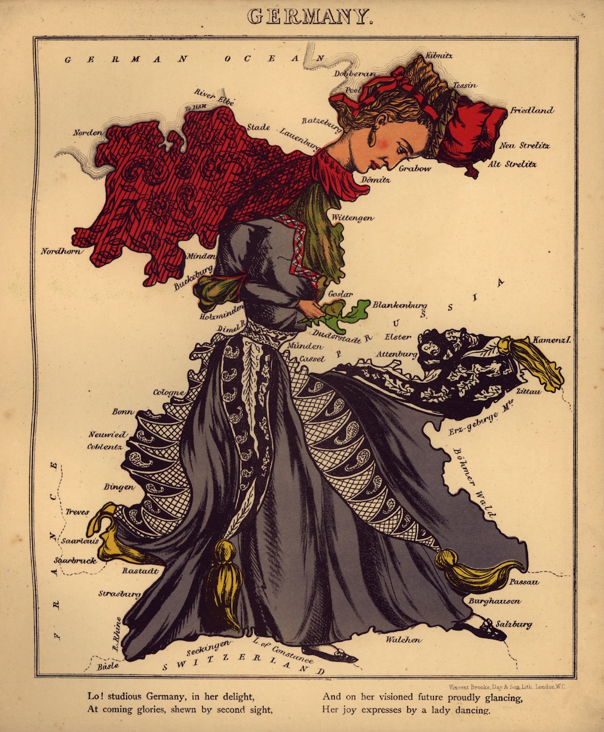
Geographical fun: being humourous outlines of various countries, with an introduction and descriptive lines is a 1860s book compiled by “Aleph”, nom de plume of London surgeon and educator William Harvey.
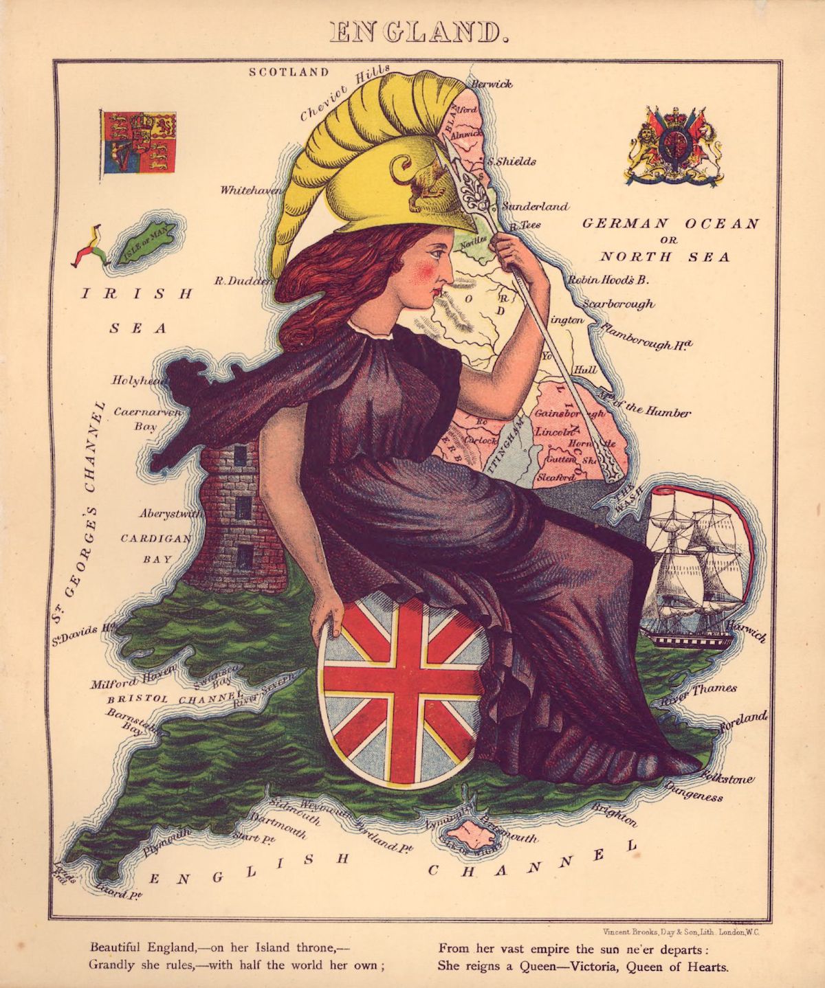
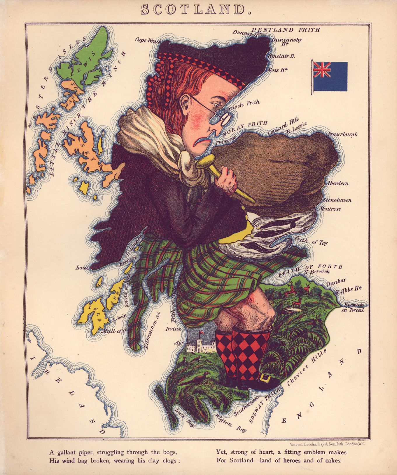
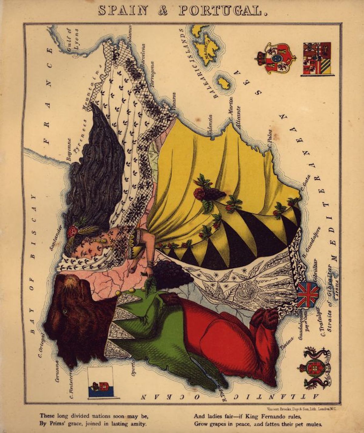
The young lady who is responsible for these Sketches is now in her fifteenth year, and her first idea of Map Drawing is traceable to her meeting with a small figure of Punch riding on a Dolphin, and contrived to represent England. The thought occurred to her when seeking to amuse a brother confined to his bed by illness. It is believed that there illustrations of Geography may be rendered educations, and prove of service to young scholars, who commonly think Globes and Maps but wearisome aids to knowledge, by enabling them to retain the outline of various counties so humourously caricatured in the work, by associating them in the mind’s eye with odd fancy figures.”
The Library of Congress adds:
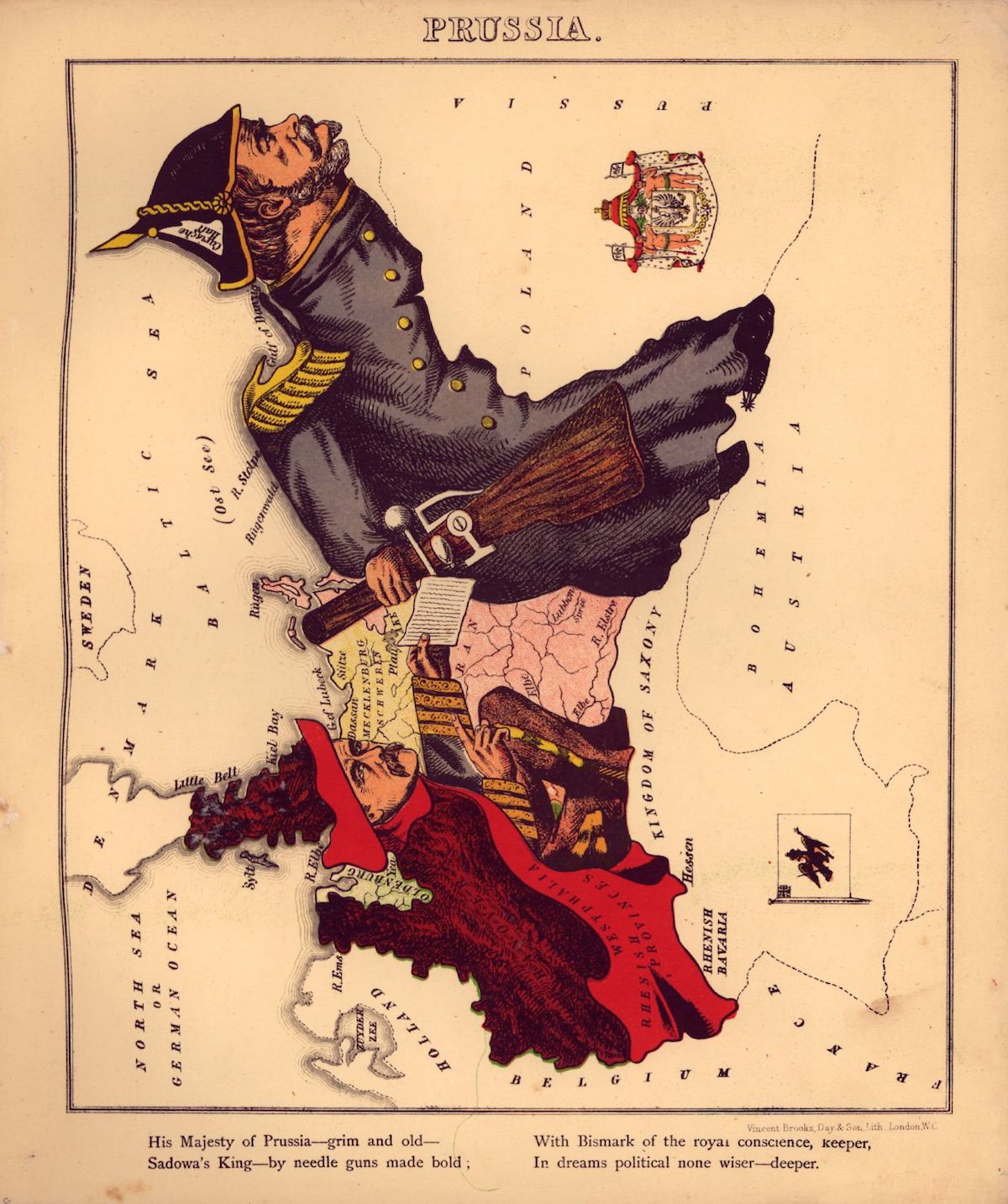
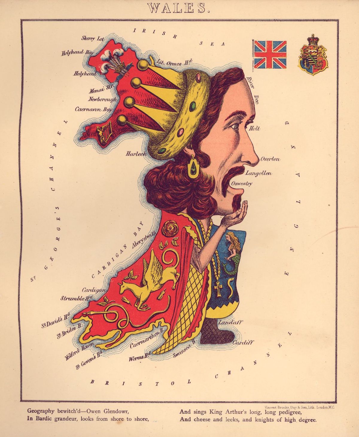
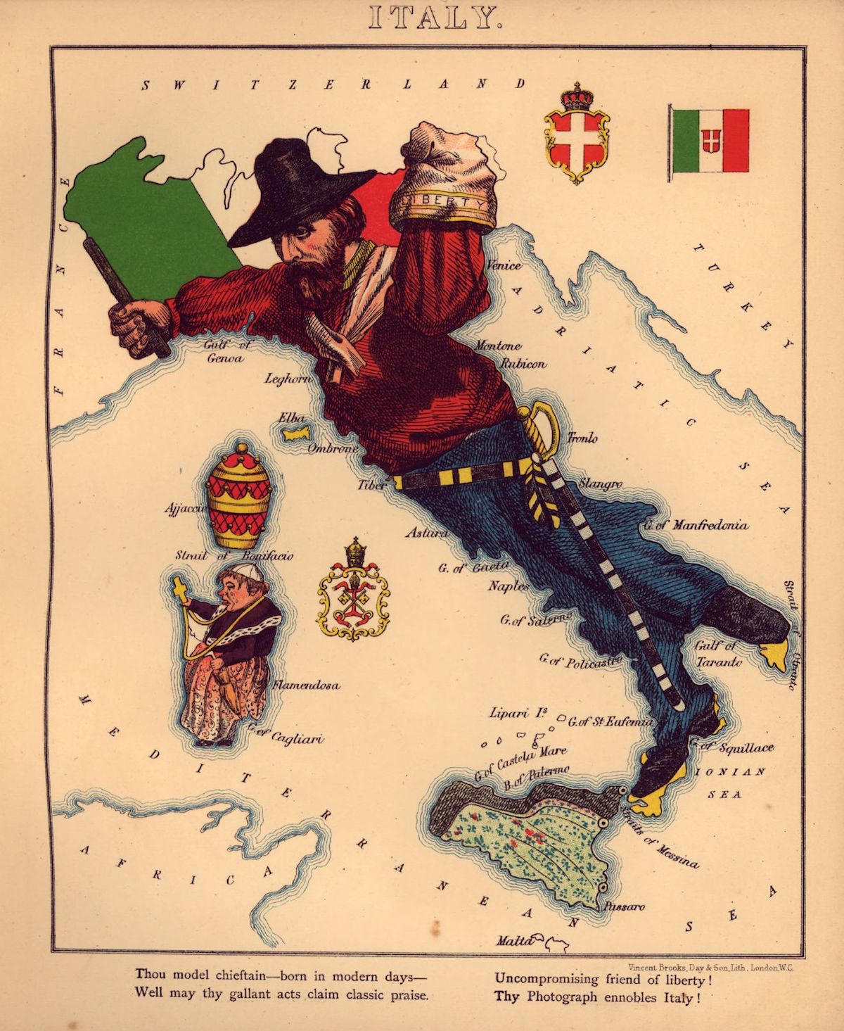
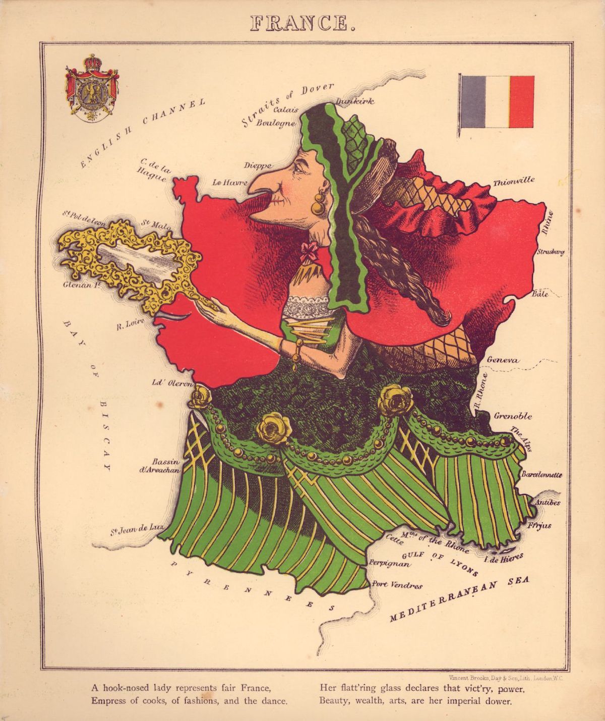
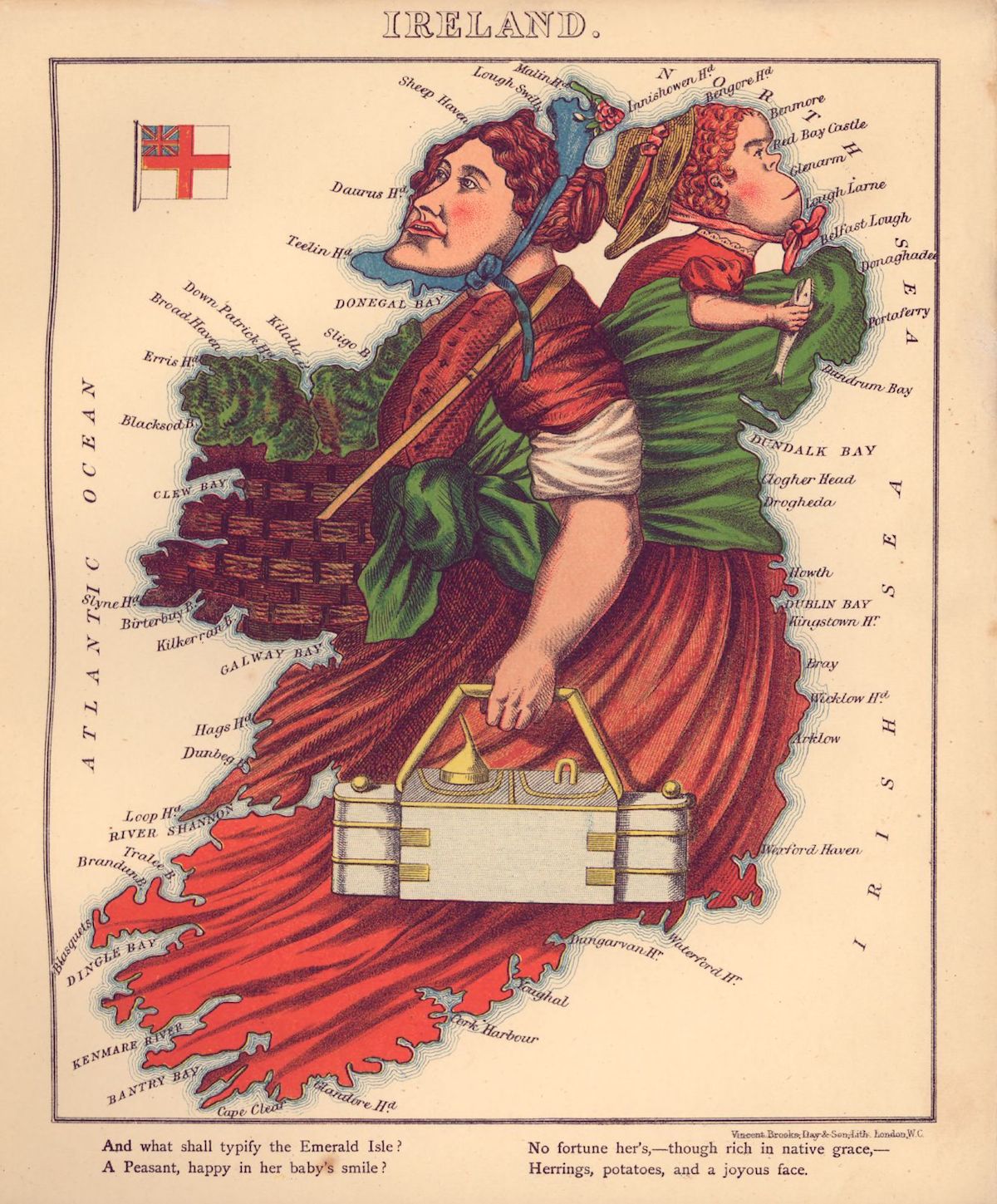
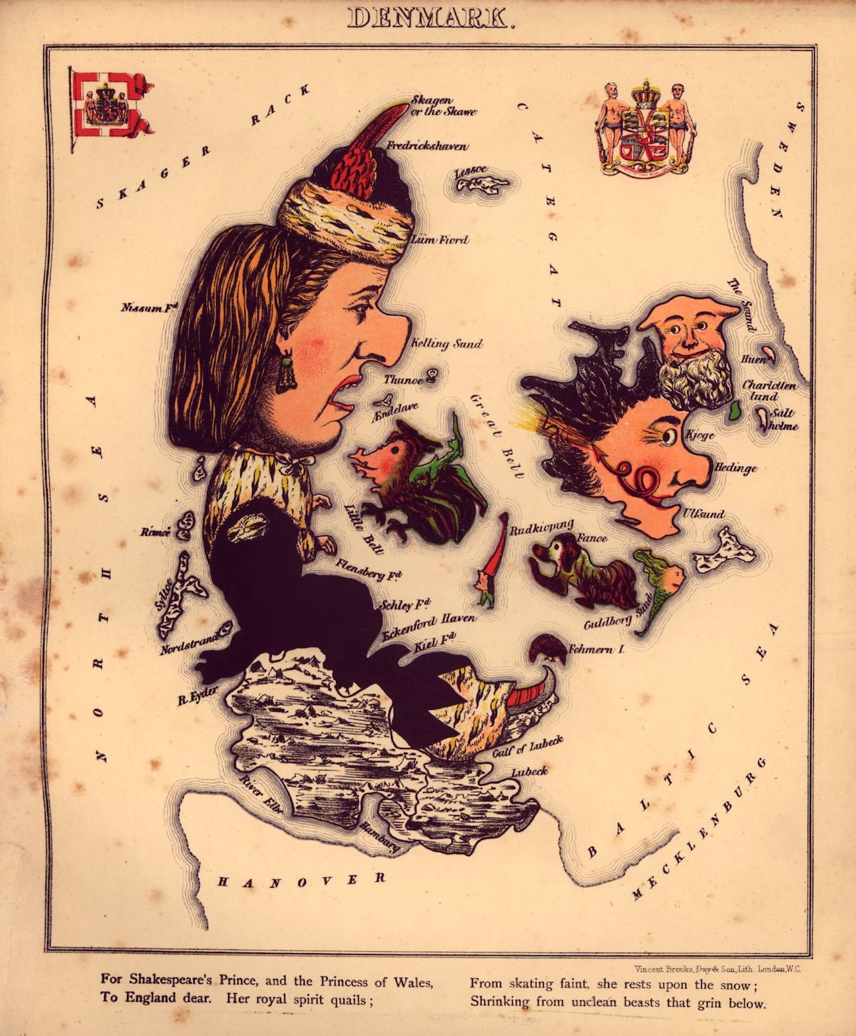
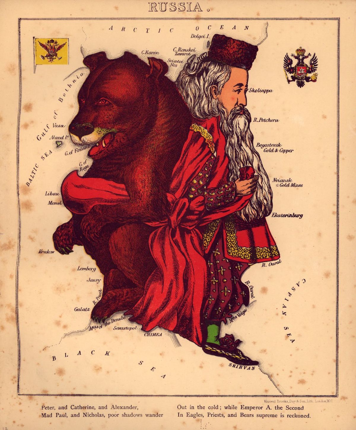
The resulting fanciful caricatures include England in the form of Queen Victoria; Scotland as a gallant Piper struggling through the bogs; Wales in the form of Owen Glendowr; Ireland as a Peasant, happy in her baby’s smile; France as an Empress of cooks, fashions, and the dance; Spain and Portugal joined in lasting amity; Italy as a revolutionary figure complete with liberty cap; Prussia in the personages of Friedrich Wilhelm and Prime Minister Bismarck; Holland and Belgium as female figures who represent a land . . . and perfect art made grand; Denmark as a female figure with ice skates; and Russia as the classic bear.


More anthropomorphic cartography here in these cartoon maps of Europe from 1870 and 1914, and also (in a slightly different direction) these landscapes containing human faces.
Would you like to support Flashbak?
Please consider making a donation to our site. We don't want to rely on ads to bring you the best of visual culture. You can also support us by signing up to our Mailing List. And you can also follow us on Facebook, Instagram and Twitter. For great art and culture delivered to your door, visit our shop.