“You know, they straightened out the Mississippi River in places, to make room for hourse and livable acreage. Occasionally the river floods these places. “Floods” is the word they use, but in fact it is not flooding; it is remembering. Remembering where it used to be. All water has a perfect memory and is forever trying to get back to where it was.”
— Toni Morrison
Harold Fisk Mississippi Maps – buy prints
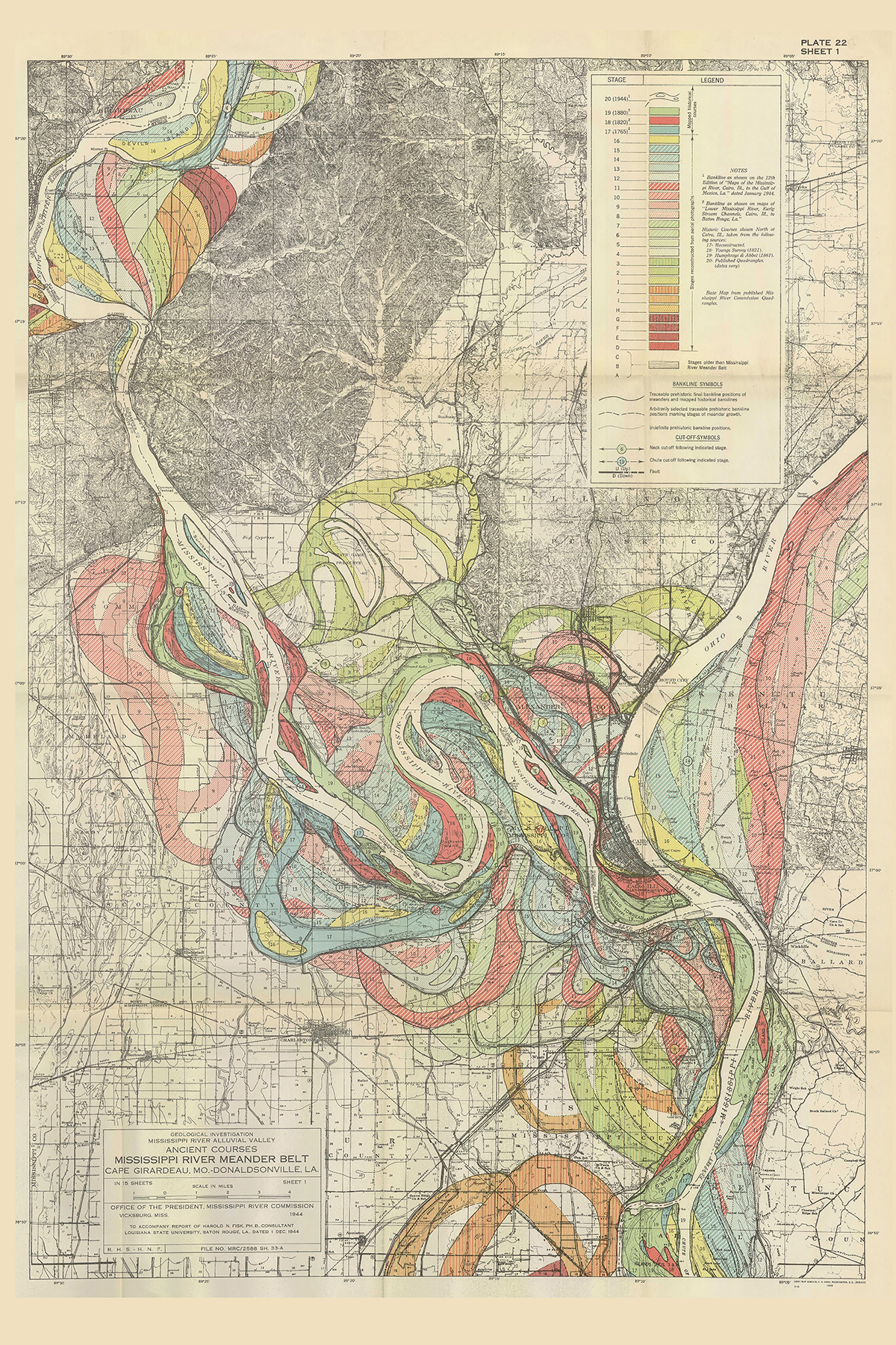
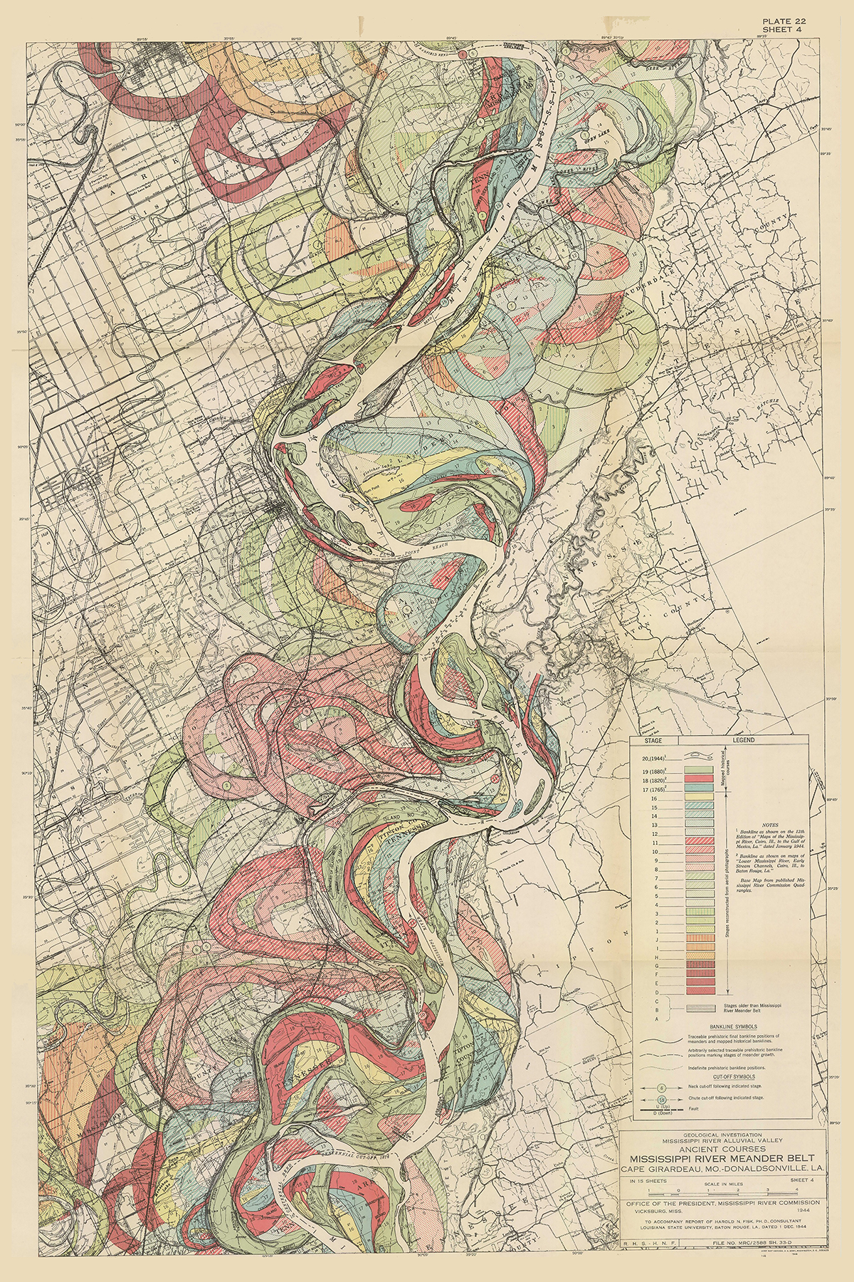
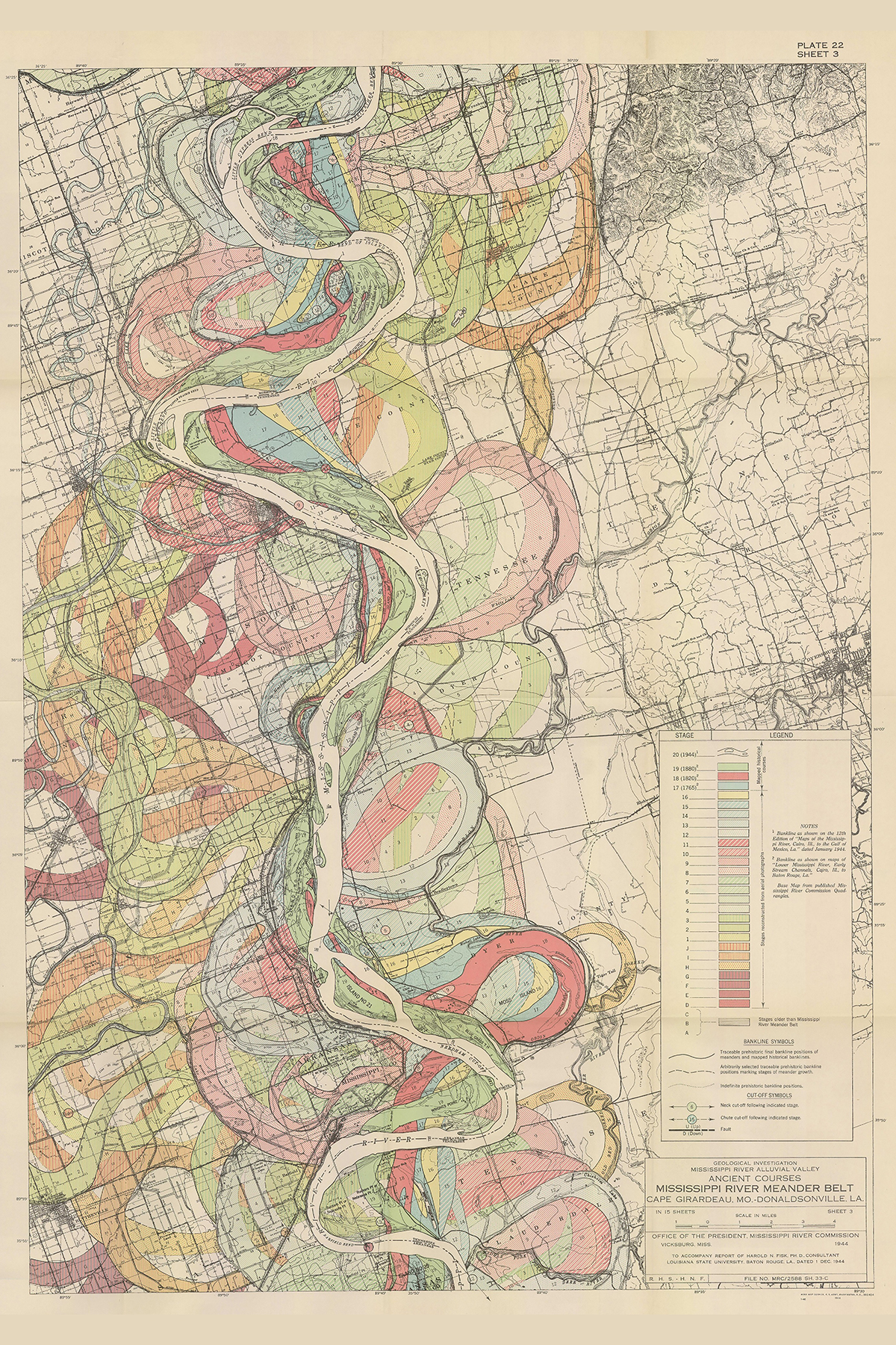
In 1944, Harold Fisk was a geologist and cartographer working for the US Army Corps of Engineers when he made these 15 maps to illustrate the government’s “Geological Investigation of the Alluvial Valley of the Lower Mississippi River”.
Fisk’s ingenious maps shows a different portion of the Mississippi and its various courses over time between Cape Girardeau, Missouri and Donaldsonville, Louisiana.
We see the Mississippi and the river’s meander belt, which is the area of a valley bottom across which the river’s channel has evolved over time. By using overlapping colours, Fisk reveals millennia of changes into a single image.
The data was collected by creating approximately 16,000 borings that made it possible to analyse the layers of soil and sediment deposits from the river’s prior courses deep underground. Fisk also drew on three historical maps (including Lieutenant Ross’ influential charting from 1765), aerial photography and geological study of the terrain.
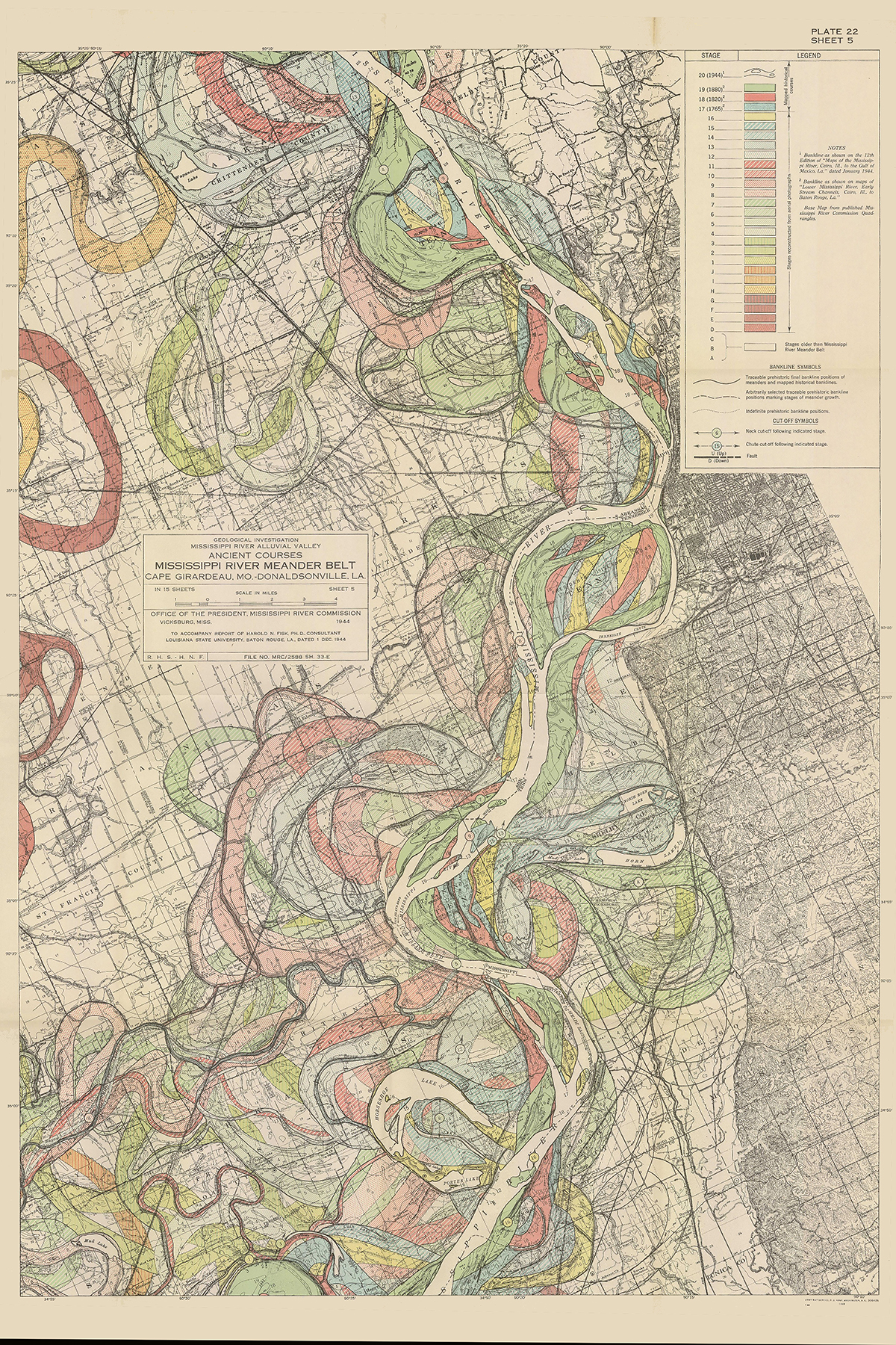
“The history [of the Mississippi Alluvial Valley] has been reconstructed from… the record of the shifts in position of the master stream and its principle tributaries and of the changes in the valley slope, stream load, and the nature of the streams which took place during and subsequent to the rise in sea level”
– Harold Fisk, Mapping The Mississippi River
You can see and buy prints of all Harold Fisk’s Mississippi River maps here.
Would you like to support Flashbak?
Please consider making a donation to our site. We don't want to rely on ads to bring you the best of visual culture. You can also support us by signing up to our Mailing List. And you can also follow us on Facebook, Instagram and Twitter. For great art and culture delivered to your door, visit our shop.