The Mauna Ulu eruption on the Kilauea Volcano, Hawaii, lasted from May 24, 1969 to July 24, 1974. It added 230 acres of new land to Hawaii’s Big Island.
Mauna Ulu eruption of the Kilauea Volcano. Dome fountain near Aloi Crater. Photo by D.A. Swanson, January 29, 1971. (USGS)
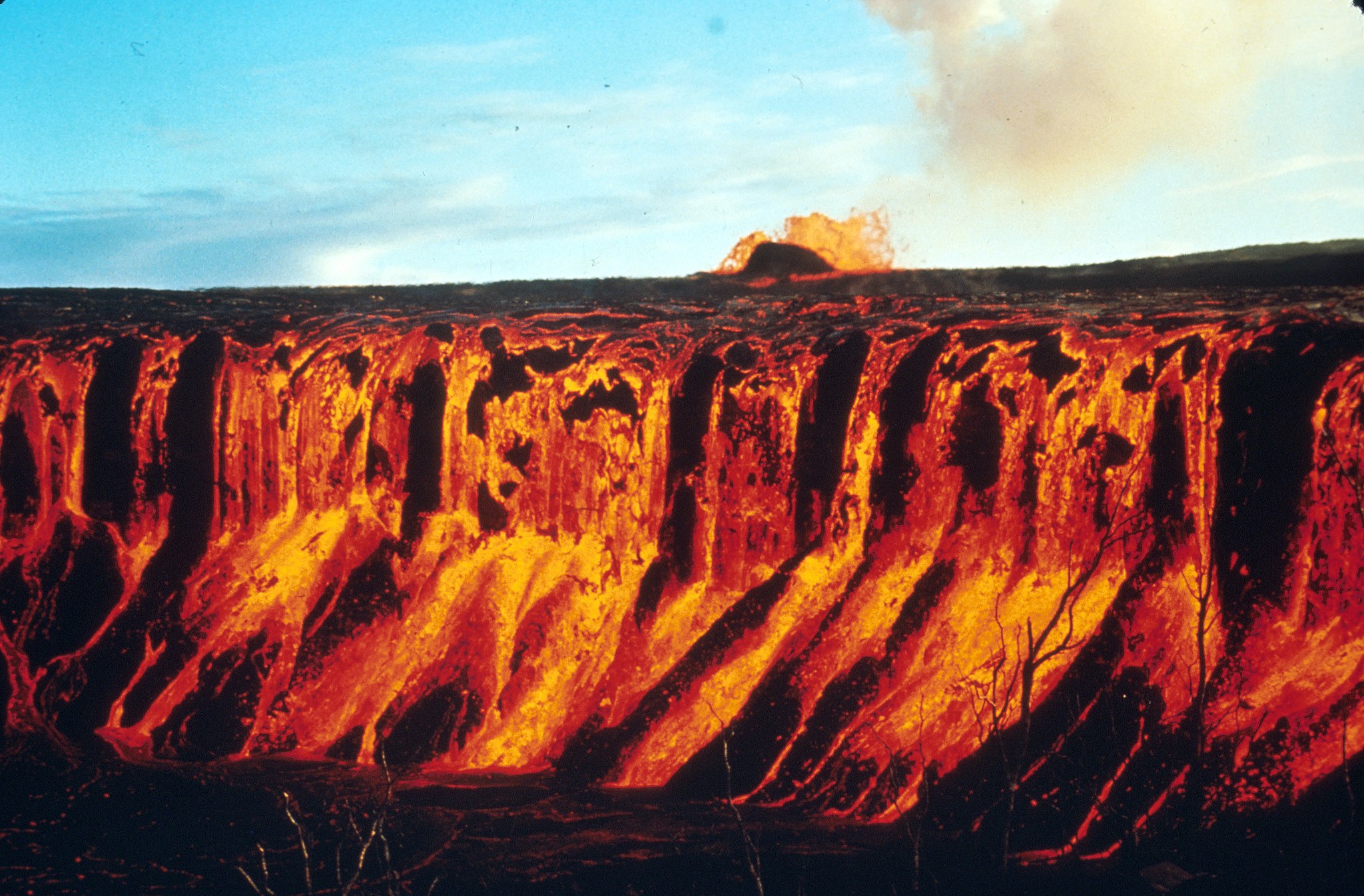
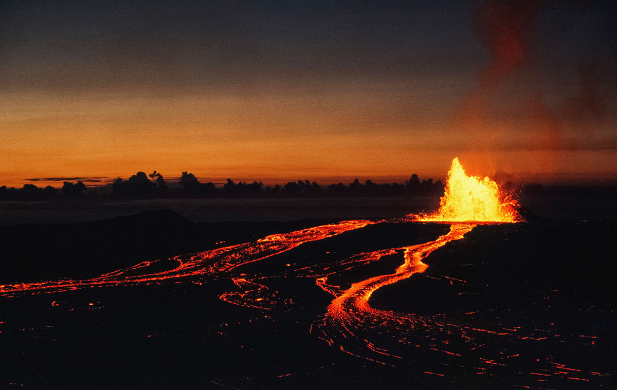
December 30, 1969: Lava fountain 300 metres (980 ft) high erupts from Mauna Ulu, feeding a lava flow that filled Alo’i crater.
Kilauea is the most active of the five volcanoes that together form the island of Hawaii. Kilauea is around 300,000 and 600,000 years old and emerged above sea level about 100,000 years ago. It has been erupting since 1983. On May 3, 2018, several lava vents opened in the lower Puna area. Nearly 2,000 residents were evacuated from Leilani Estates and the adjacent Lanipuna Gardens development. By May 9, 2018 the eruption had destroyed 27 houses in the Leilani Estates subdivision.

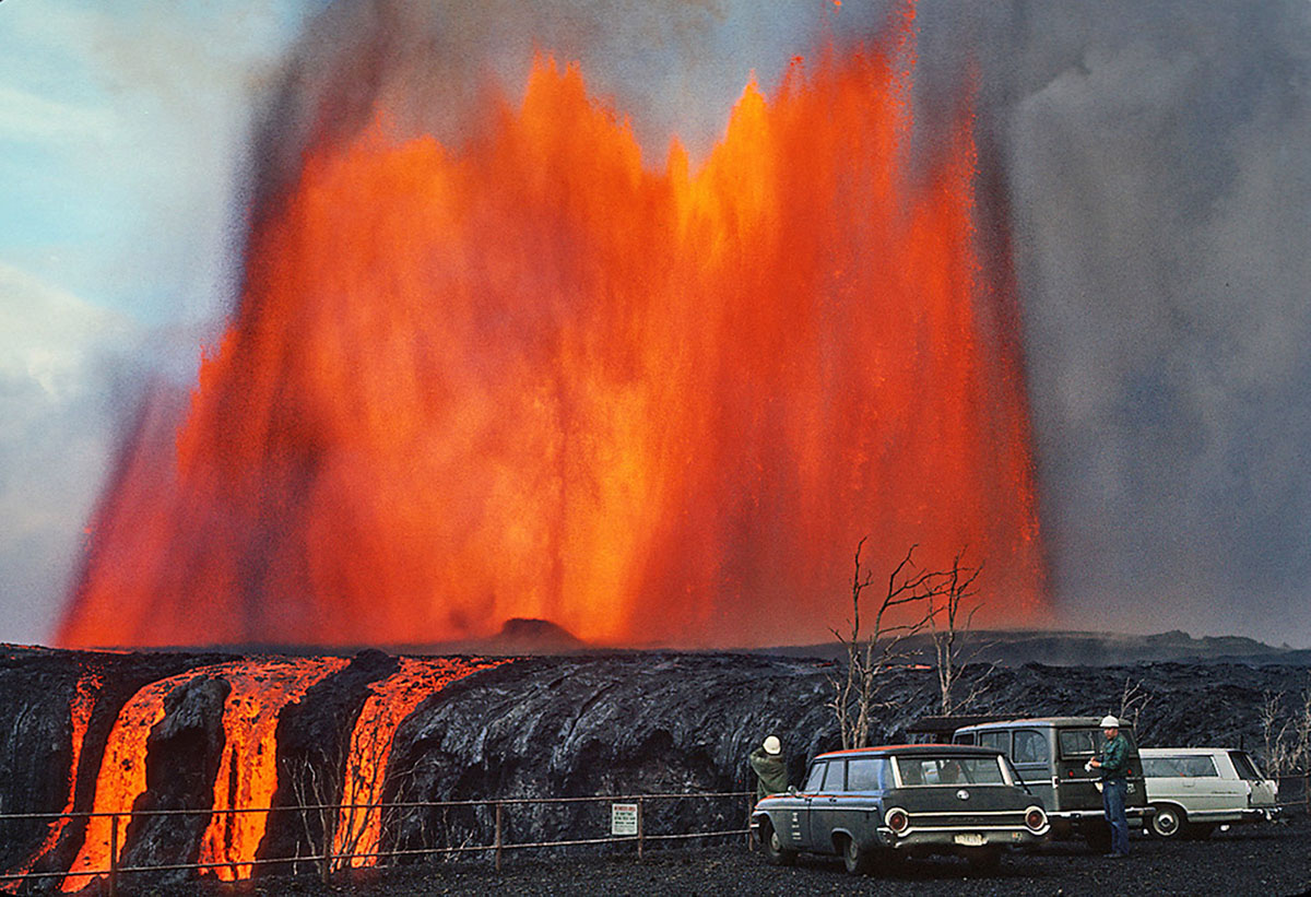
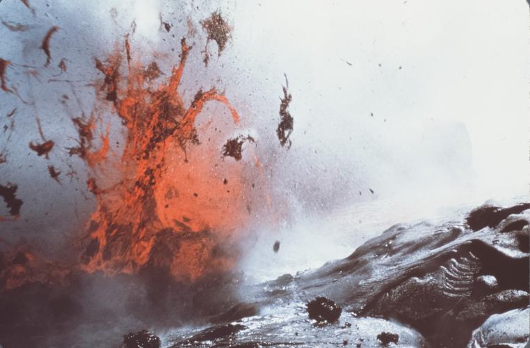
Hawaii Volcanoes National Park. 1969-1971 Mauna Ulu eruption of Kilauea Volcano. Aloi cascade with geologists in the foreground. Mauna Ulu fountain in the distance. December 30, 1969. (J.B. Judd / USGS)
Hawaii Volcanoes National Park. 1969-1971 Mauna Ulu eruption of Kilauea Volcano. Cascade and fountain into Aloi Crater. Photo by D.A. Swanson, December 30, 1969.
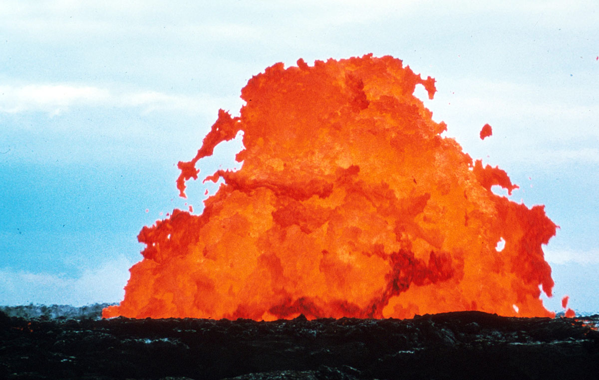
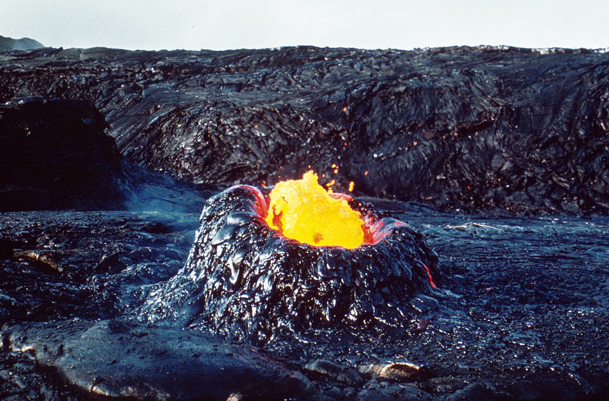
Dome fountain of episode 10, October 10–13, 1969. Photo taken on October 11. This dome fountain is about 20 m (65 ft) high. Symmetrical dome fountains such as this are rare. (USGS)

Hawaii Volcanoes National Park. 1969-1971 Mauna Ulu eruption of Kilauea Volcano. Slump at the edge of Alae Crater on Chain of Craters road. Photo by D.A. Swanson, June 29, 1969. (USGS)
Hawaii Volcanoes National Park. 1969-1971 Mauna Ulu eruption of Kilauea Volcano. Fountains arching from vents on the east flank of Mauna Ulu. Photo by D.W. Peterson, 3:24 p.m., October 15, 1970. Photos hvo00140, hvo00141, hvo00142, and hvo00143 form a sequence. (USGS)
Kilauea East Rift: Roofed tube, looking S. Note ledges w/in tube, indicating different levels of flows. Tube at roof crossing looking south. Skylight in lava tube carrying lava from ‘Alae crater onto to Kīlauea’s south flank, October 21, 1970. For much of 1970 and into 1971, lava flowed through a tube from Mauna Ulu into a complex lava lake in ‘Alae Crater. The lake built natural levees, which allowed lake level to rise much higher than the old crater rim. Lava tubes developed in the levees as exits for lava entering the lake. This photo shows one such exit tube. (USGS)
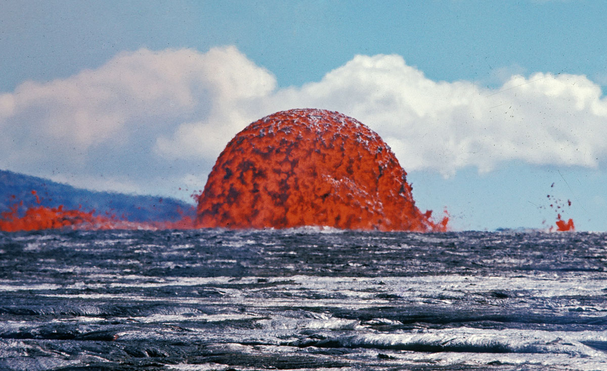
Hawaii Volcanoes National Park. 1969-1971 Mauna Ulu eruption of Kilauea Volcano. Spectacular lava fountain. February 1970. (USGS)

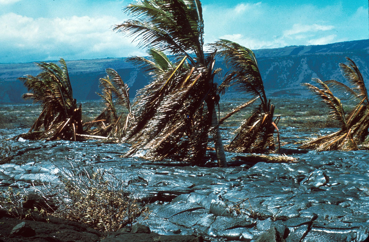
Hawaii Volcanoes National Park. 1969-1971 Mauna Ulu eruption of Kilauea Volcano. Coconut grove near Kahue Point after being surrounded by lava. Photo by D.W. Peterson, @1:35 p.m., September 21, 1970. (USGS)
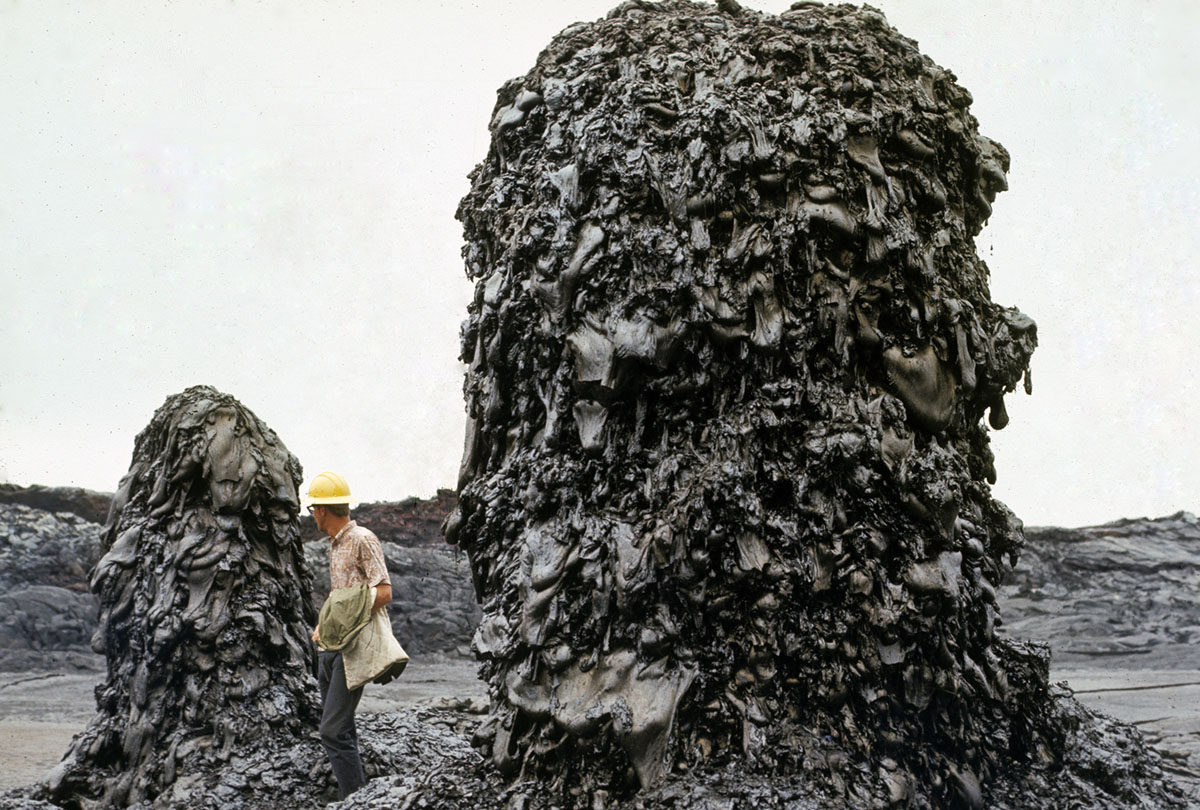
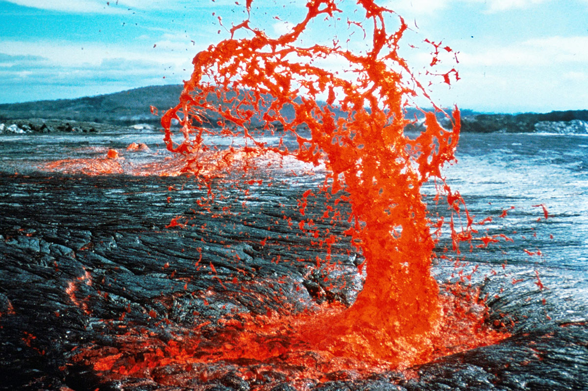
– Jeff Judd in front of bee hive spatter chimney, Aloi DAS “JJudd at hornito in Aloi. These spires developed on the surface of the lava fill in the crater. Since there was a fissure active in the crater on April 9, 1970, it is uncertain if these spires were true hornitos or were fed from the fissure. (USGS)
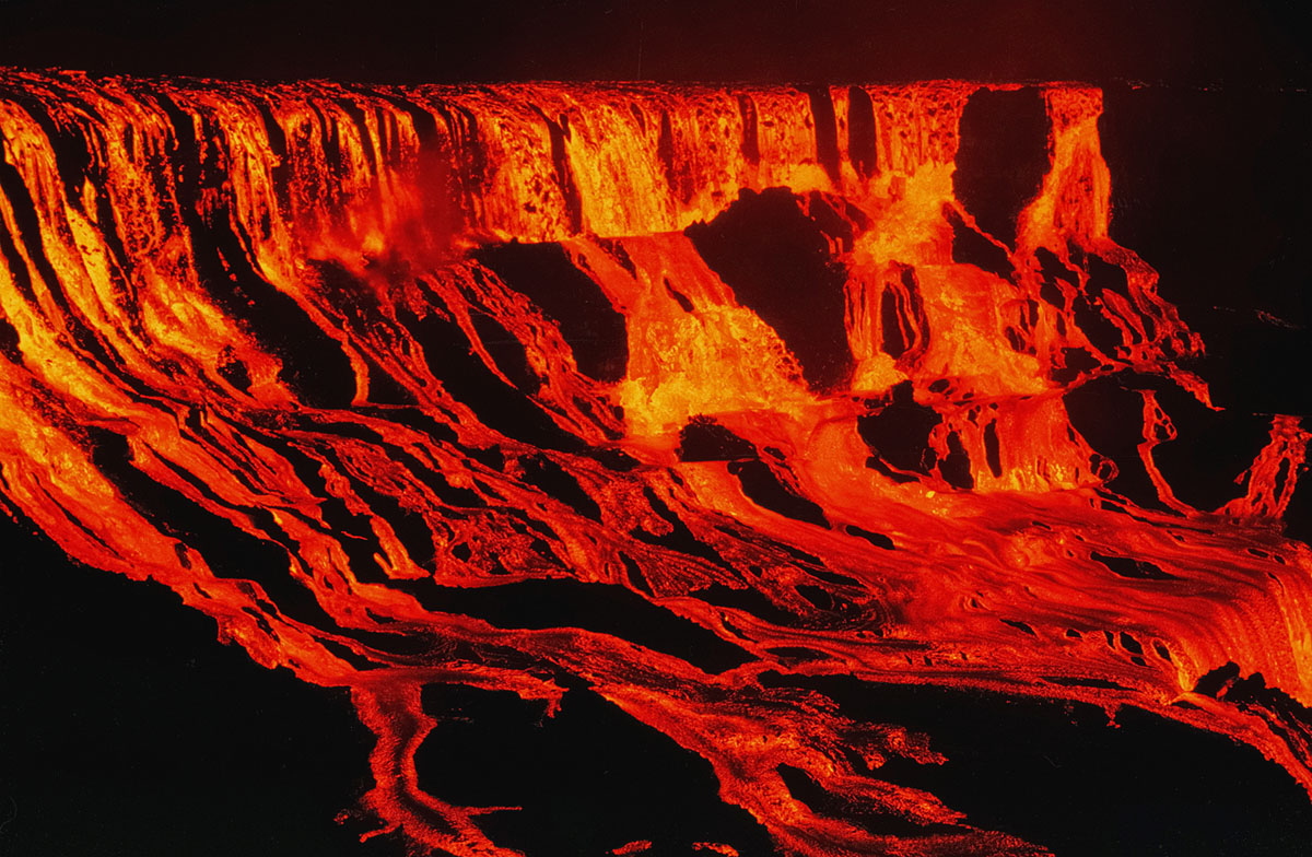
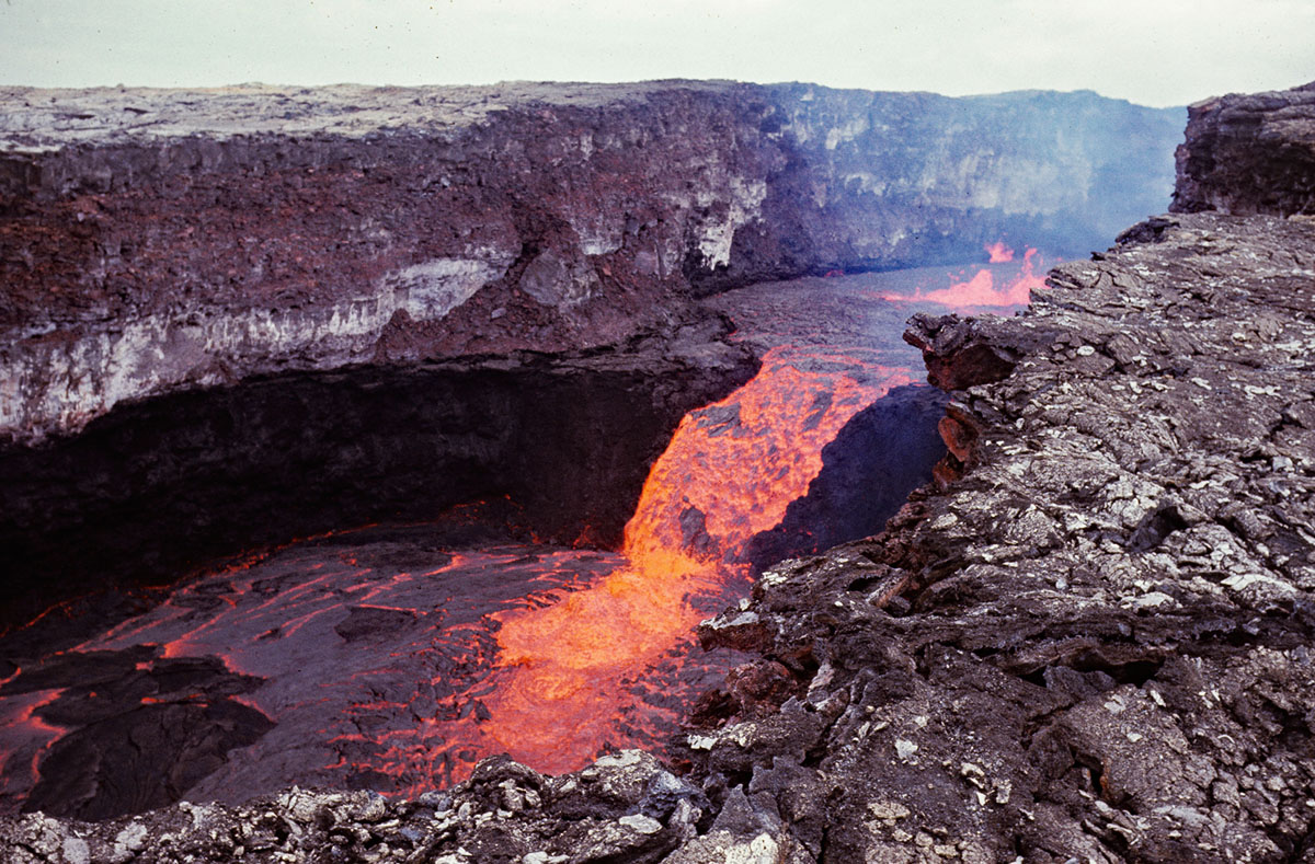
Kilauea E. rift: Mauna Ulu, Lava fall into Alae from SW corner of crater. Lava falls higher than American Falls at Niagara begin to fill ‘Alae Crater on August 5, 1969 following the catastrophic draining on August 4. Renewed fountaining at Mauna Ulu sent lava shown in the photo into ‘Alae, starting to refill the crater. Photo taken from same location as the preceding image. The mezzanine is the lower level, and lava plunges off it into the deeper pit. The total height of the lava falls is more than 100 m (330 ft), and the width more than 300 m (1000 ft). For the two seasoned observers who witnessed this awe-inspiring event, nothing else matched it during the entire Mauna Ulu eruption. (USGS)
Kilauea E. rift: Mauna Ulu summit cascade into fissure through after subsidence of lava in trench, with opening of tube to Alae. Lava flowing from the summit crater of Mauna Ulu eastward into a pool at the west end of the trench February 7, 1972. This was only about 4 days after eruptive activity resumed at Mauna Ulu after temporarily ending on October 15, 1971. Lava flowed down the trench and reoccupied the lava tube into ‘Alae. (USGS)
Hawaii Volcanoes National Park. 1969-1971 Mauna Ulu eruption of Kilauea Volcano. Hornito in Aloi Crater, approximately 5 feet wide and 3 feet high. Photo by J.B. Judd, May 20, 1970. (USGS)
Hawaii Volcanoes National Park. 1969-1971 Mauna Ulu eruption of Kilauea Volcano. Spatter from explosion of lava at the shore. Photo by D.W. Peterson, April 12, 1971. (USGS)
Hawaii Volcanoes National Park. 1969-1971 Mauna Ulu eruption of Kilauea Volcano. Aa flows at the base of Holei Pali. Photo by D.W. Peterson, February 28, 1971. (USGS)
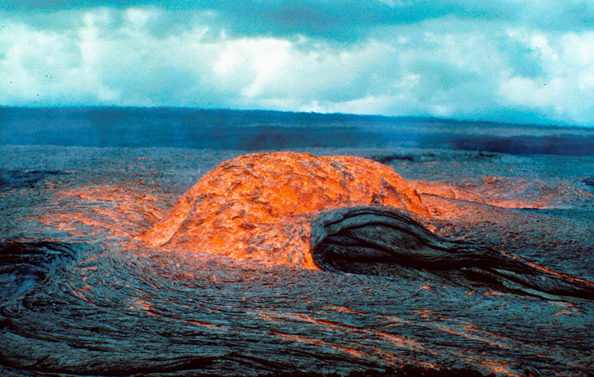
Photo id: 254849 – Hawaii Volcanoes National Park. 1969-1971 Mauna Ulu eruption. Hawaii Volcanoes National Park. 1969-1971 Mauna Ulu eruption of Kilauea Volcano. Artesian fountain venting near West Vent(?) cone, flows moving south. May 28, 1970. (USGS)
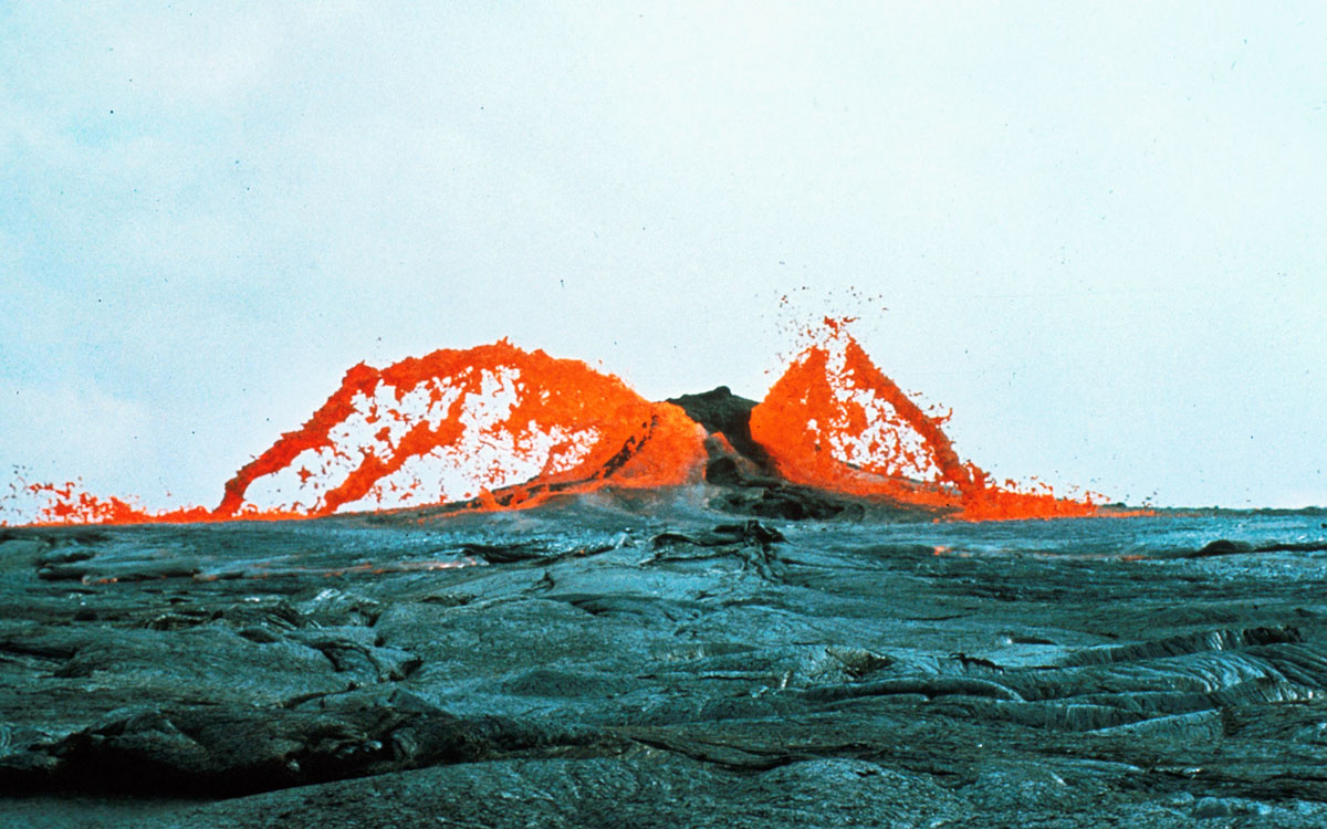
Kilauea E. Rift: Mauna Ulu fountain and flows. 25(19) View from Pu‘u Huluhulu of renewed shield growth, January 30, 1974.
Low fountains and repeated overflows at the Mauna Ulu crater build the shield higher. Lava flows were mostly brief and short, thereby increasing the relief between the top of the shield and its base. The perched lava pond shown in the previous photo is bypassed by the two rivers. (USGS)

A great photo of a glowing tree mold in the shape of a heart from the October 1968 eruption of Kilauea volcano in Hawaii Volcanoes National Park. This photo was taken west of Napau Crater. Credit: D.A. Swanson, Oct 12, 1968.
Via: USGC, The Atlantic
Would you like to support Flashbak?
Please consider making a donation to our site. We don't want to rely on ads to bring you the best of visual culture. You can also support us by signing up to our Mailing List. And you can also follow us on Facebook, Instagram and Twitter. For great art and culture delivered to your door, visit our shop.