In the 1860s and 1870s, photographer Timothy O’Sullivan (1840 – 1882) was part of a government-run team of artists, soldiers, scientists, and photographers tasked with documenting America’s frontier in the West. His photographs of the landscape and people of the West touch on the sublime. The wilderness has rarely looked as spectacular.
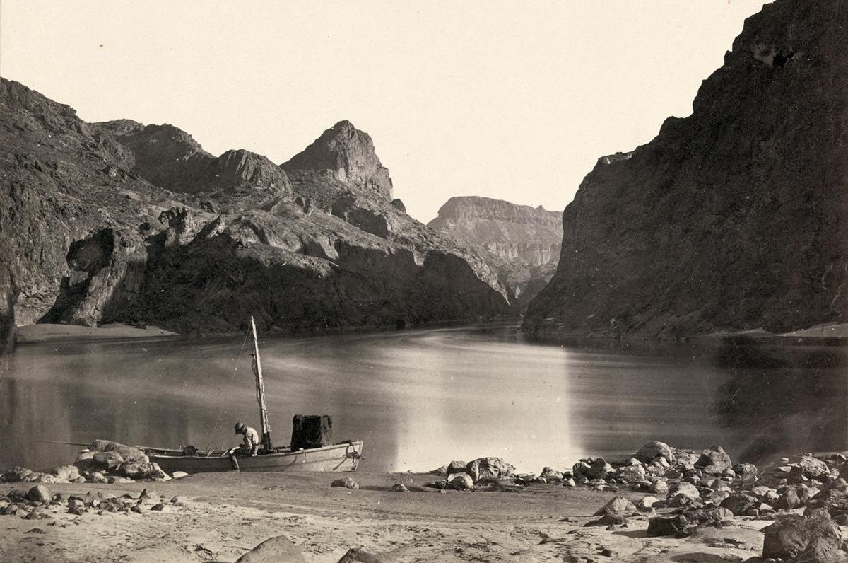
Colorado River in the Black Canyon, Mojave County, Arizona – 1871
“It’s one of the most sublime pictures of the 19th century,” says Terry Etherton of the above photograph – ‘Black Canyon looking above from Camp 8, Colorado River, Arizona, 1871.’ “What’s great is that it’s a flat-out beautiful image, and it has so much stuff about the history of photography. Because of the time exposure the water is smoothed out. The sky is neutral because it was not sensitive to emulsions–you could picture clouds only through a separate negative. The sky becomes a neutral space, a sculptural element.”
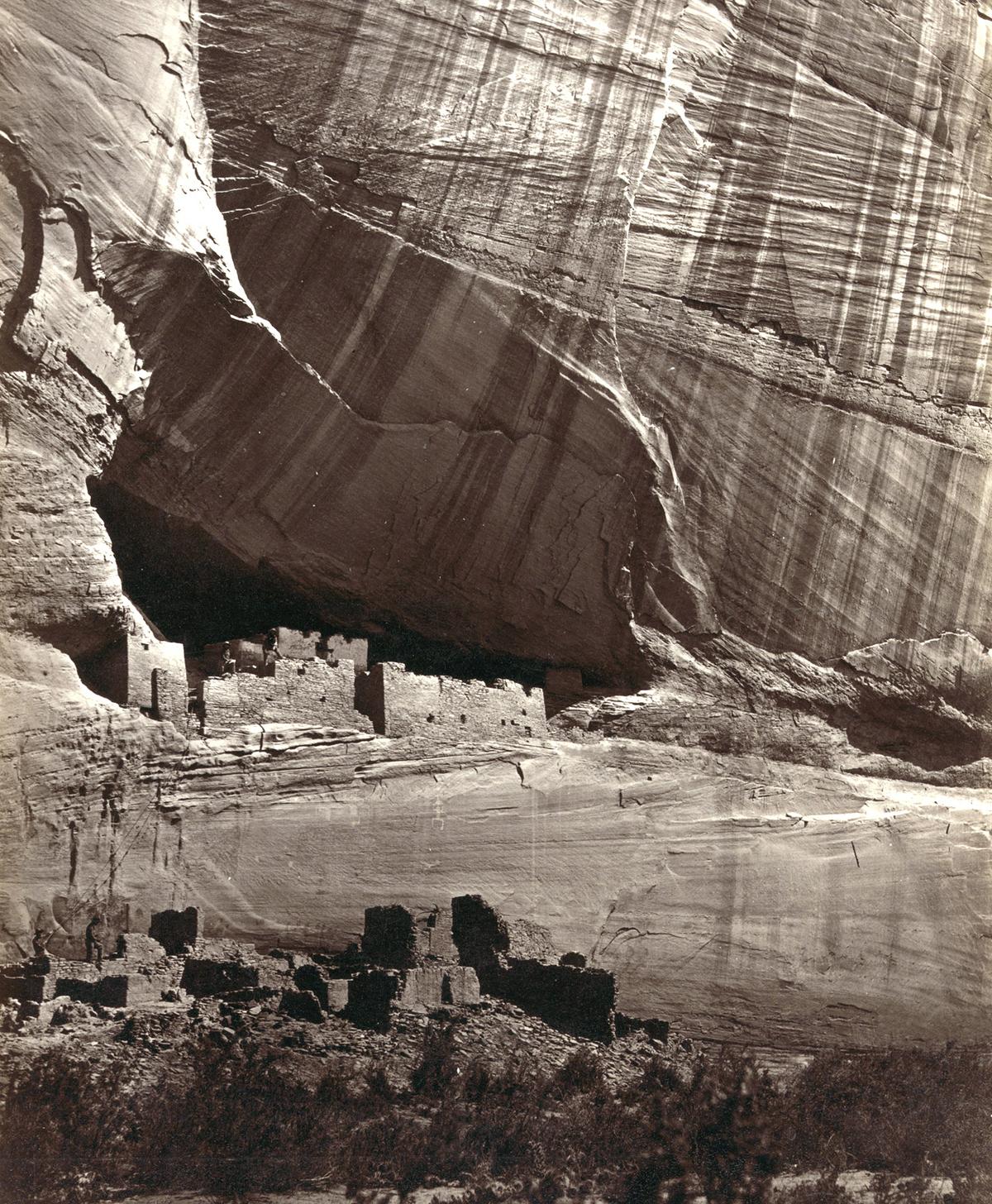
White House, Ancestral Pueblo Native American (Anasazi) ruins in Canyon de Chelly, Arizona, America in 1873. The cliff dwellings were built by the Anasazi more than 500 years earlier
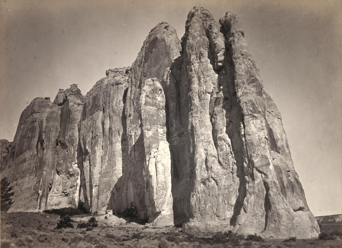
The south side of Inscription Rock (renamed El Morro National Monument), in New Mexico – 1873. Note the small figure of a man standing at bottom center. The prominent feature stands near a small pool of water, and has been a resting place for travelers for centuries. Since at least the 17th century, natives, Europeans, and later American pioneers carved names and messages into the rock face as they paused. In 1906, a law was passed, prohibiting further carving
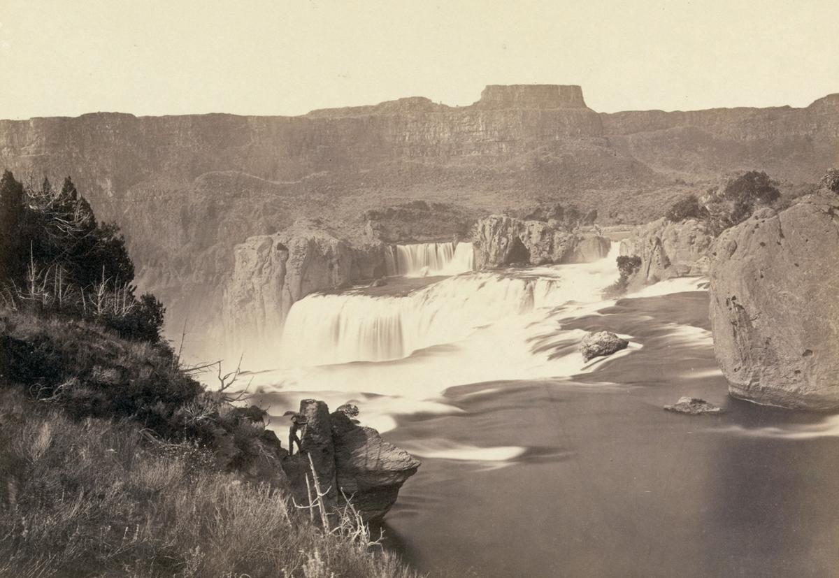
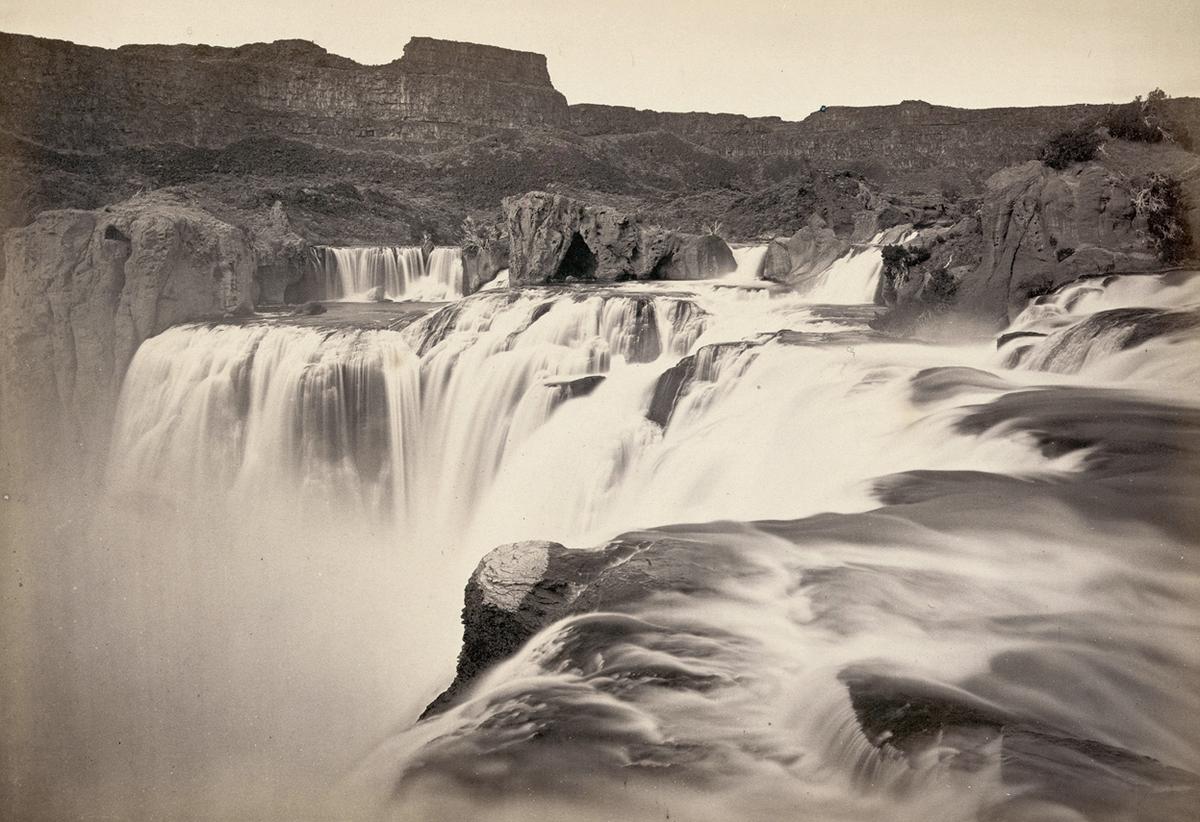
Shoshone Falls, Idaho, in 1868. Shoshone Falls, near present-day Twin Falls, Idaho, is 212 feet high, and flows over a rim 1,000 feet wide
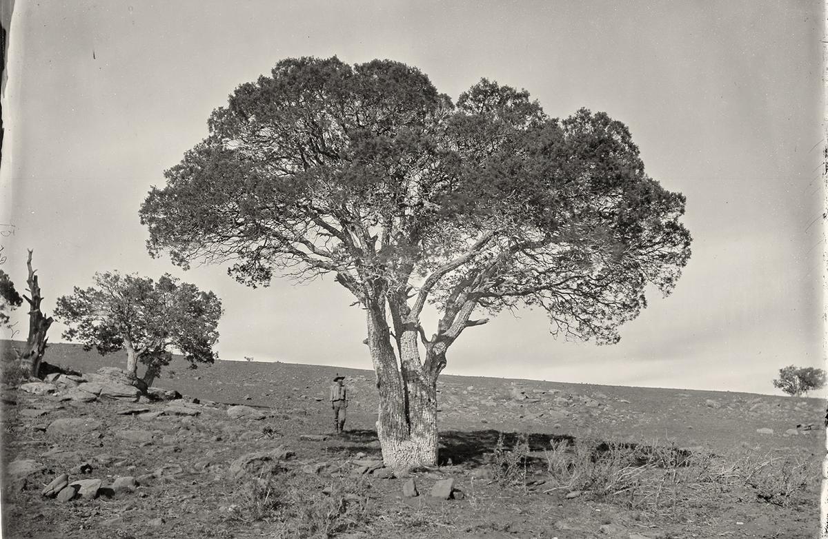
Oak Grove, White Mountains, Sierra Blanca, Arizona in 1873.
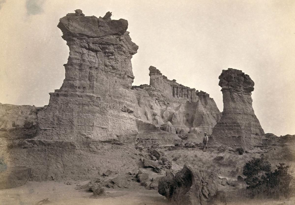
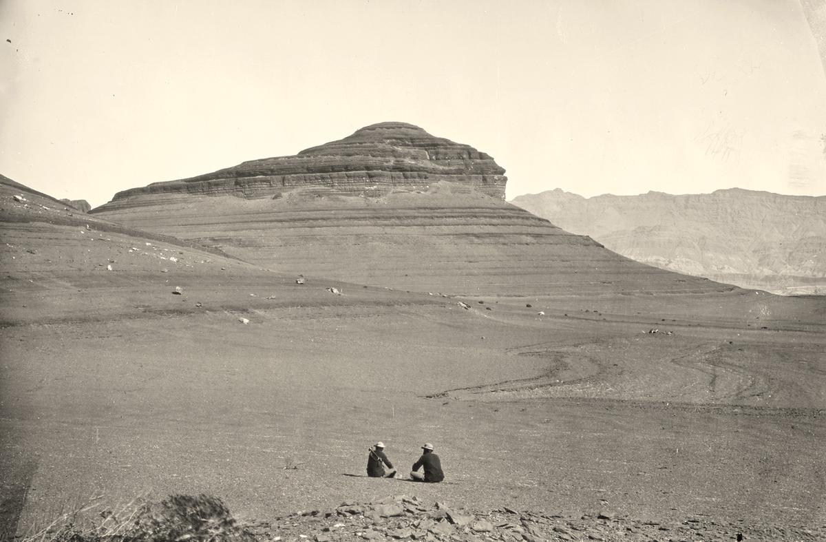
Rock formations in the Washakie Badlands, Wyoming, America, in 1872. A survey member stands at lower right for scale.
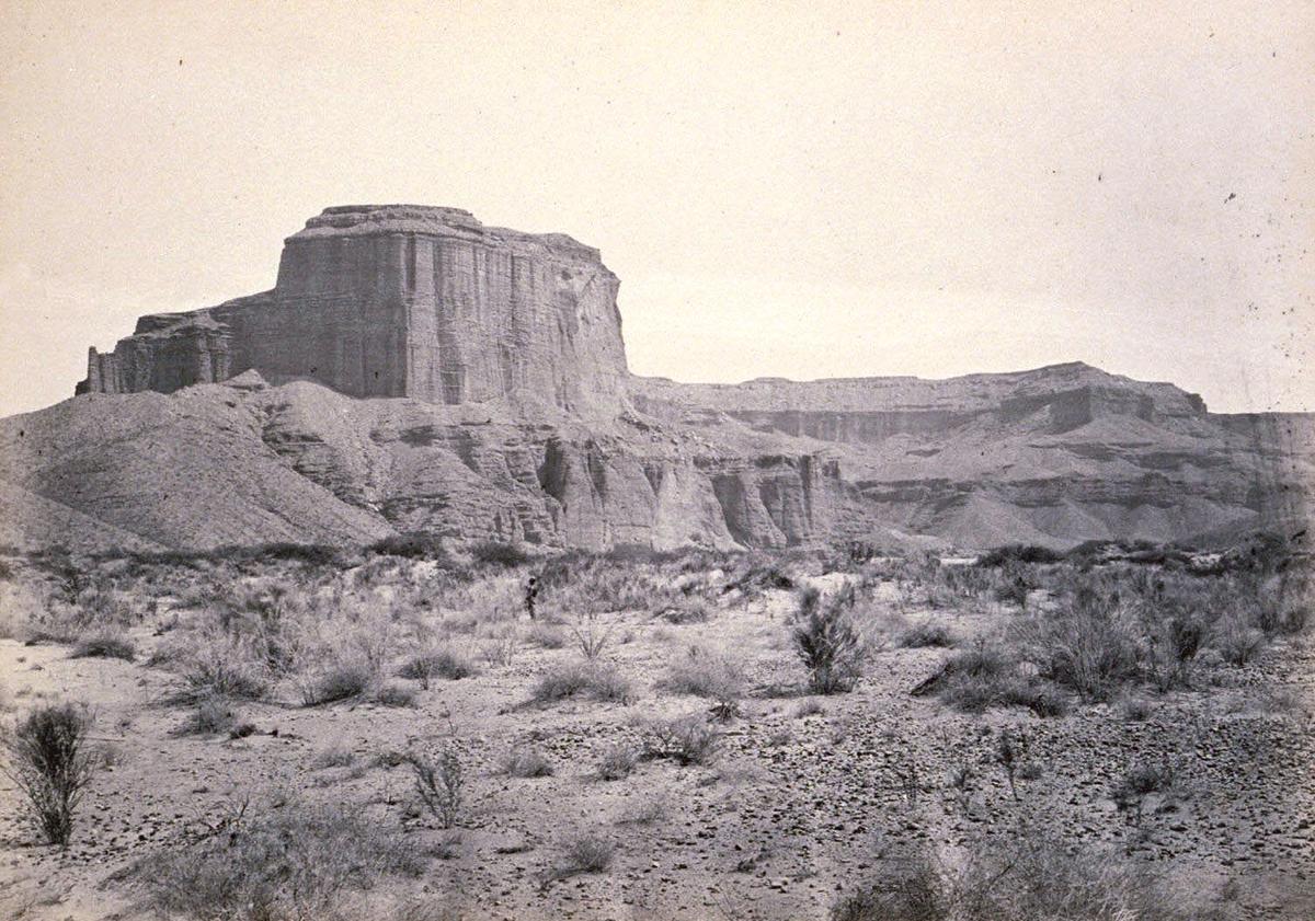
Cathedral Mesa, Colorado River, Arizona, 1871

Big Cottonwood Canyon, Utah, in 1869. Note man and horse near the bridge at bottom right.
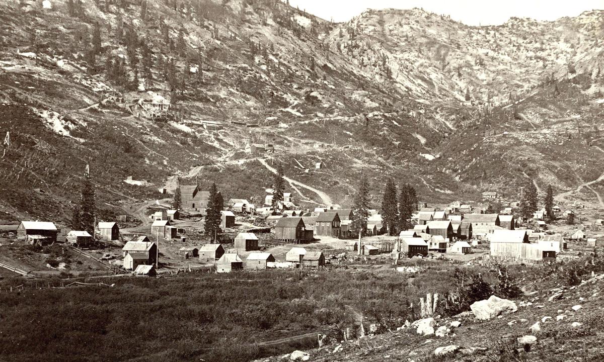
Alta City, Little Cottonwood, Utah, ca. 1873.
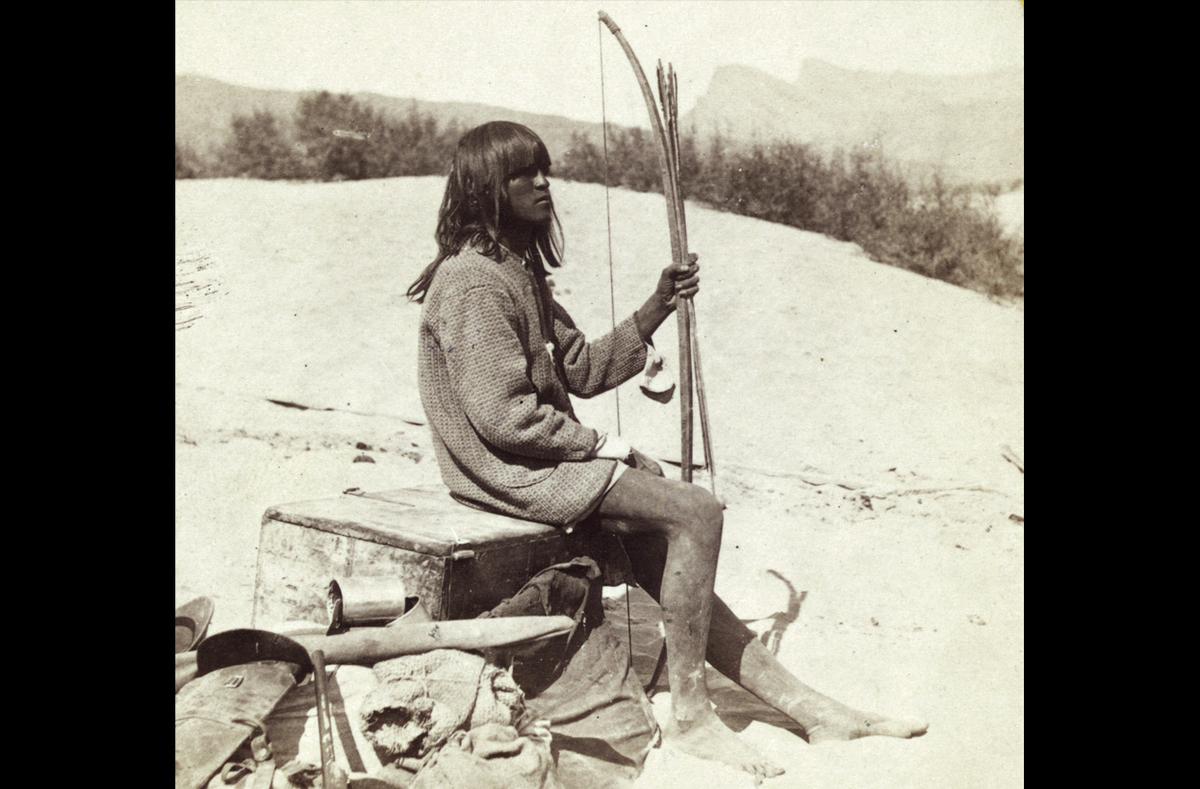
Maiman, a Mojave Indian, guide and interpreter during a portion of the season in the Colorado country, in 1871
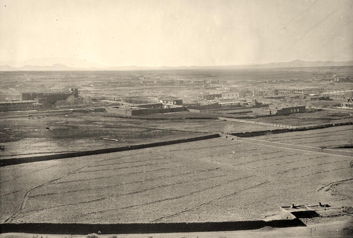
Santa Fe, New Mexico in 1873
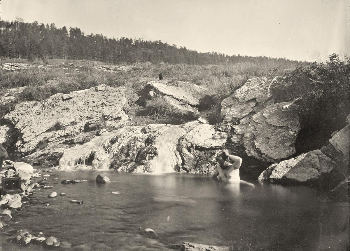
Pagosa Hot Spring, Colorado – 1874
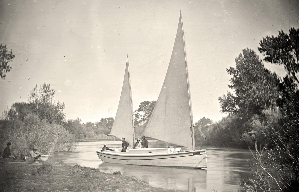
The “Nettie”, an expedition boat on the Truckee River, western Nevada, in 1867
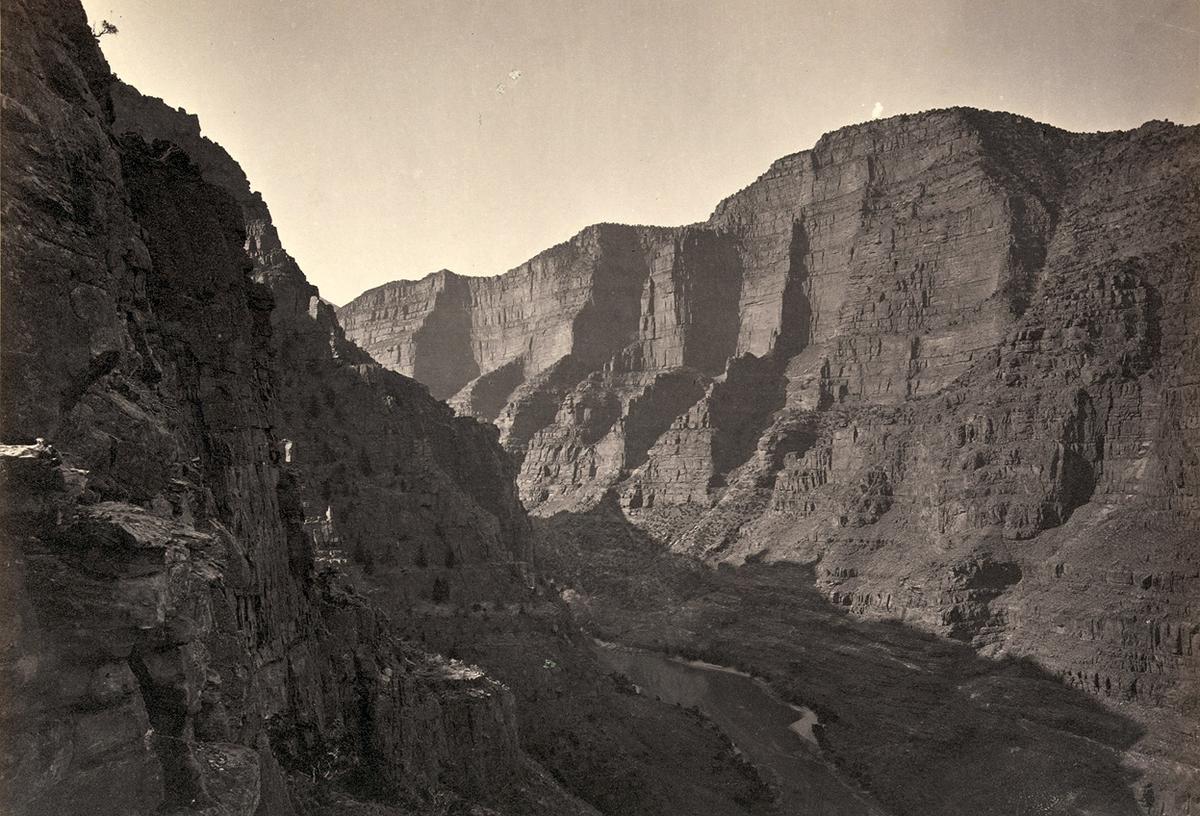
Canyon of Lodore, Colorado, in 1872
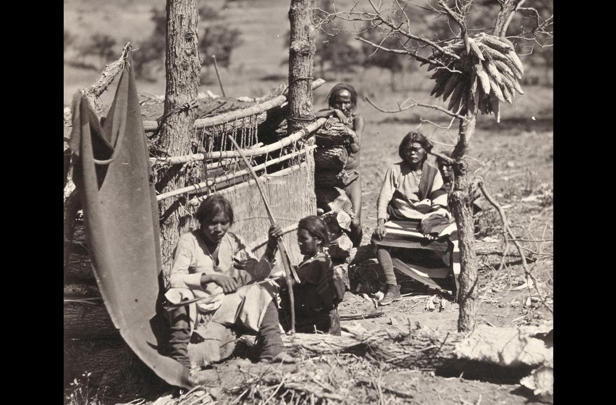
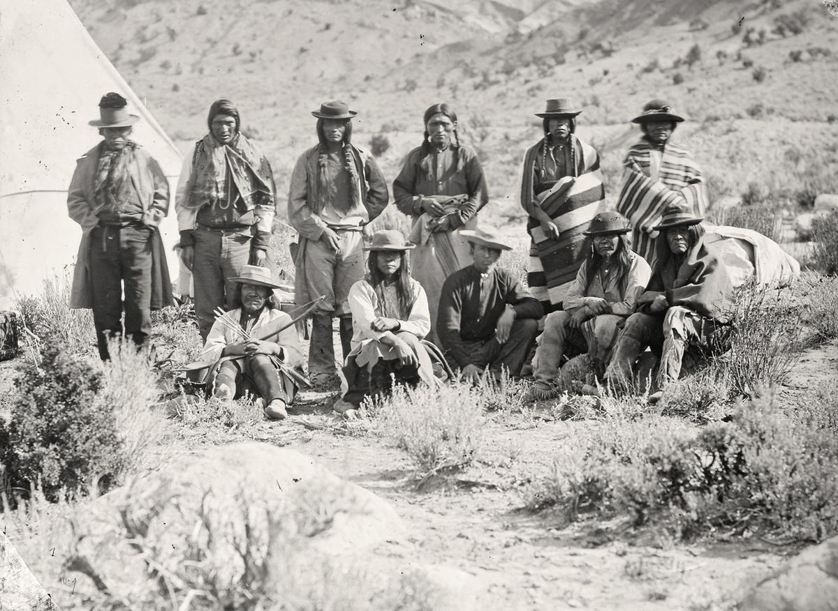
Navajo Indians. Near old Fort Defiance, New Mexico, in 1873
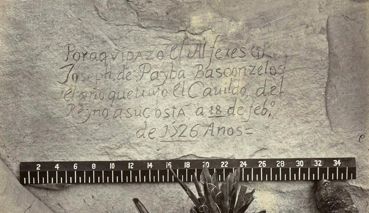
Spanish inscription from 1726. This close-up view of the inscription carved in the sandstone at Inscription Rock (El Morro National Monument), New Mexico reads, in English: “By this place passed Ensign Don Joseph de Payba Basconzelos, in the year in which he held the Council of the Kingdom at his expense, on the 18th of February, in the year 1726”
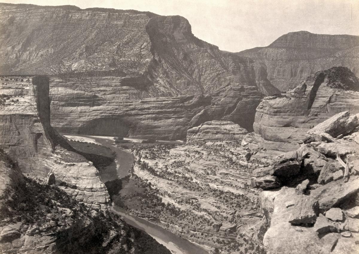
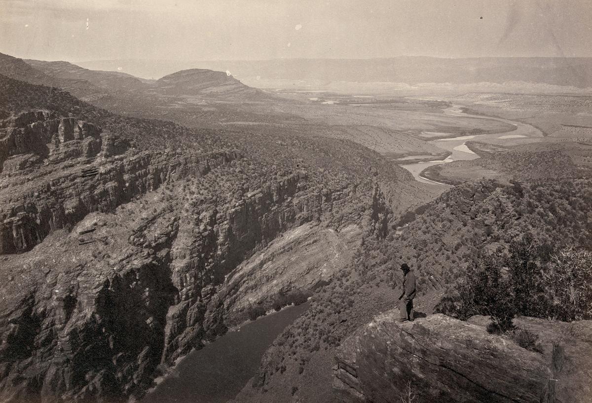
Green and Yampah Canyons, in Utah, in 1872
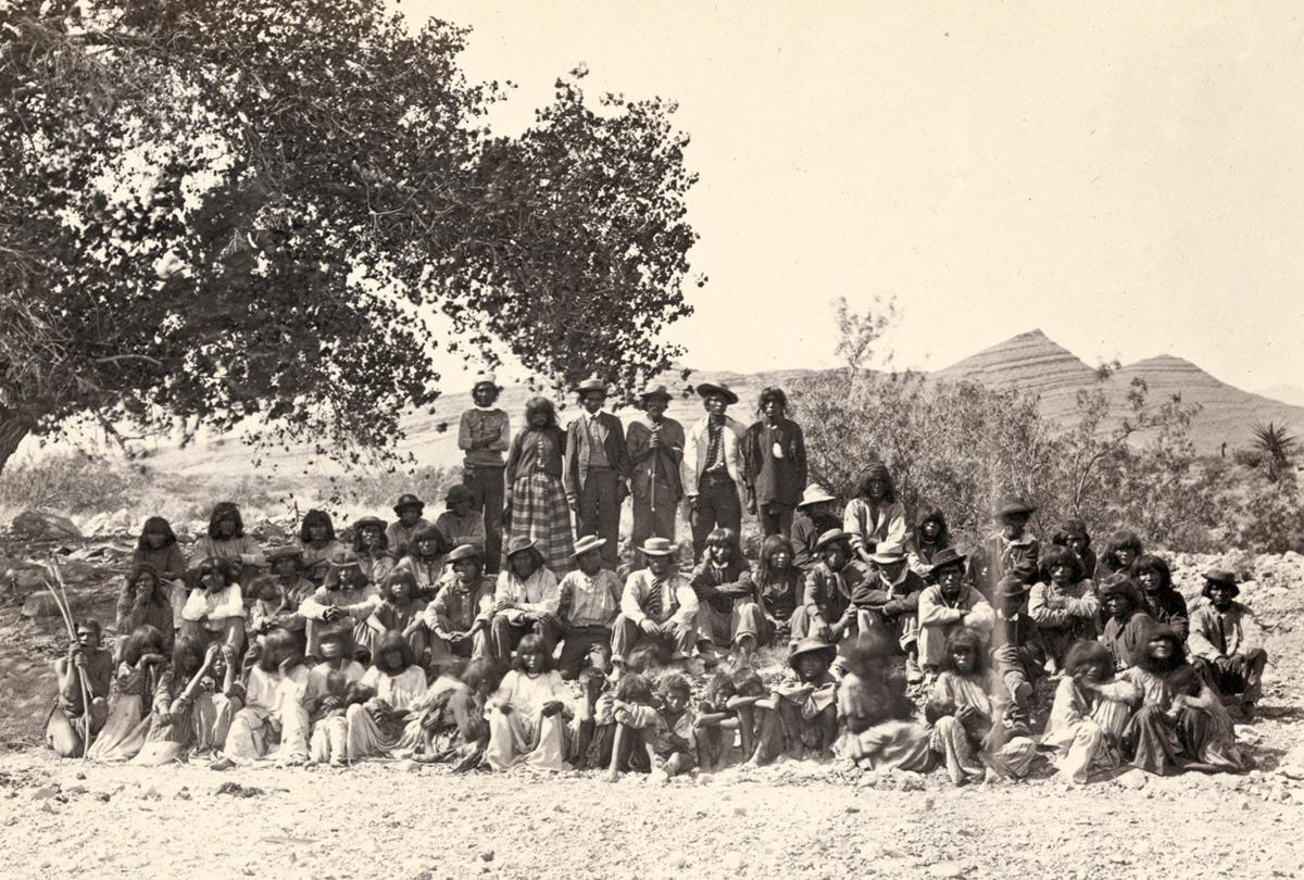
Native American (Paiute) men, women and children sit or stand and pose in rows under a tree near probably Cottonwood Springs (Washoe County), Nevada, in 1875
North of the Colorado River Plateau, 1872
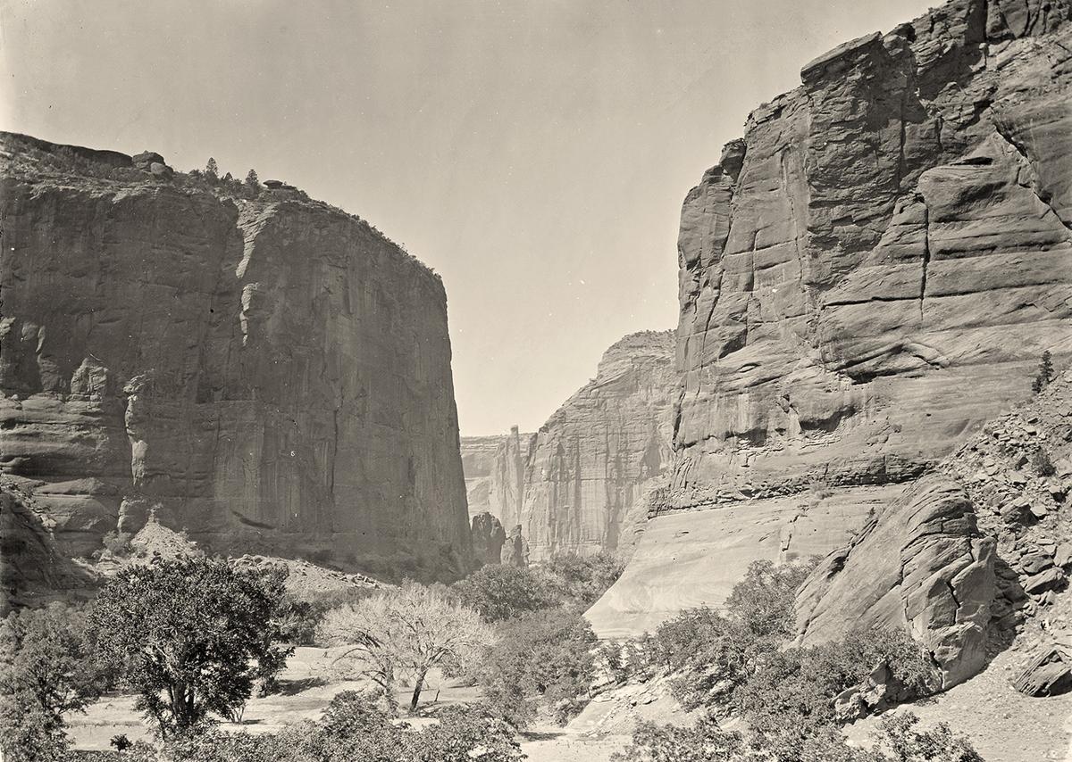
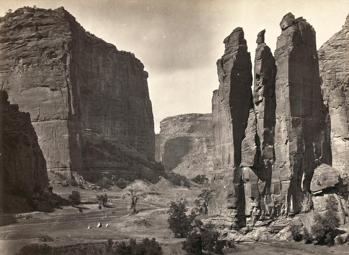
Canyon de Chelly, looking past walls that rise some 1,200 feet above the canyon floor, in Arizona in 1873
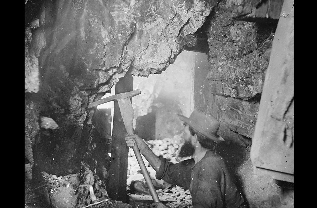
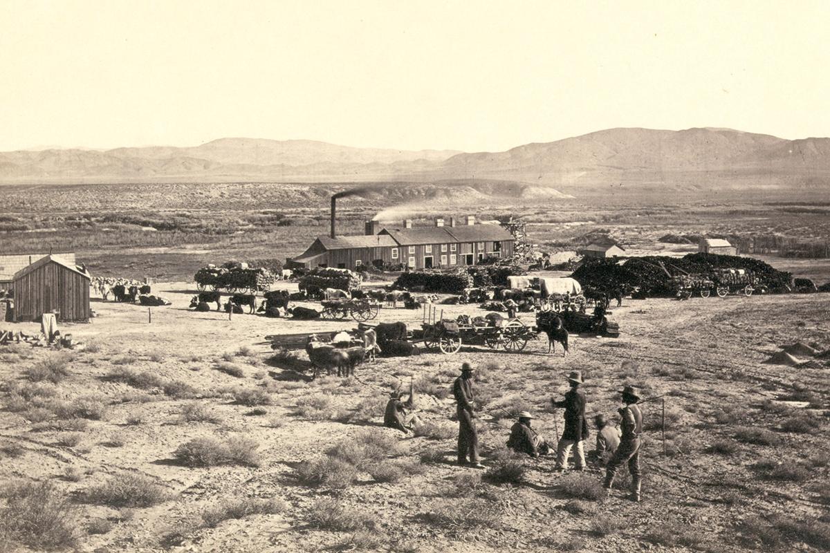
1867 – Timothy O’Sullivan photographed miners at the Savage, the Gould and Curry mines on the Comstock Lode, Nevada.

A wooden balanced incline used for gold mining, at the Illinois Mine in the Pahranagat Mining District, Nevada in 1871
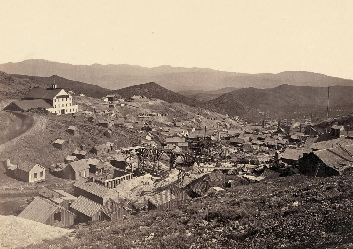
Gold Hill, just south of Virginia City, Nevada, in 1867
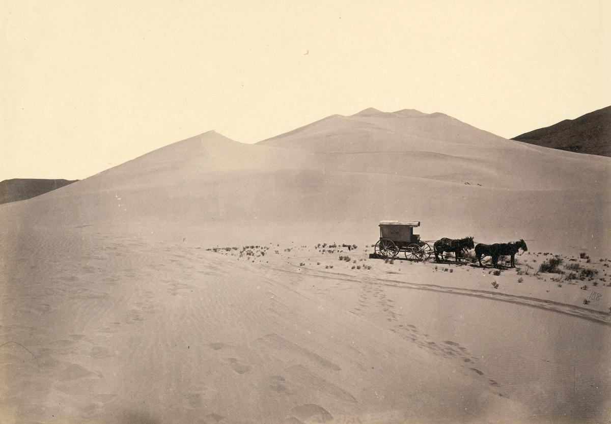
Timothy O’Sullivan’s darkroom wagon, pulled by four mules, entered the frame at the right side of the photograph, reached the center of the image, and turned around, heading back out of the frame. Footprints lead from the wagon toward the camera, revealing the photographer’s path. Photo taken in 1867, in the Carson Sink, part of Nevada’s Carson Desert

Colorado River in Iceberg Canyon, on the border of Mojave County, Arizona, and Clark County, Nevada in 1871
Shoshone Falls, Snake River, Idaho. A view across top of the falls in 1874
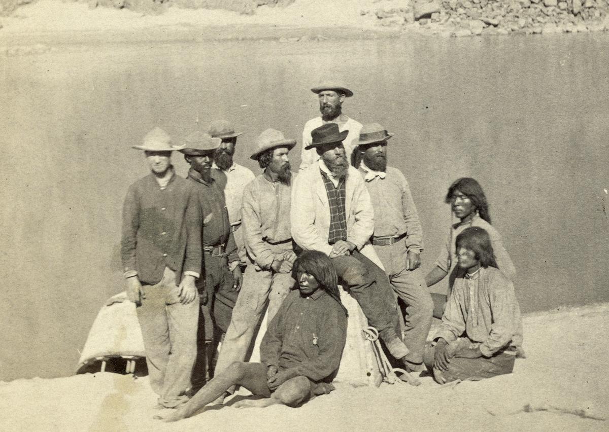
Boat crew of the “Picture” at Diamond Creek. Photo shows photographer Timothy O’Sullivan, fourth from left, with fellow members of the Wheeler survey and Native Americans, following ascent of the Colorado River through the Black Canyon in 1871
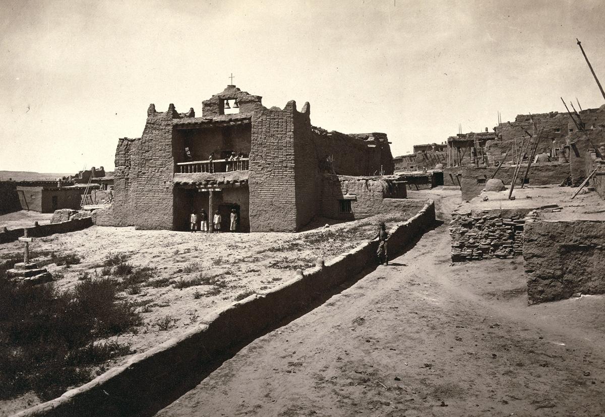
Old Mission Church, Zuni Pueblo, New Mexico. View from the plaza in 1873
Panoramic view of tents and a camp identified as “Camp Beauty”, rock towers and canyon walls in Canyon de Chelly National Monument, Arizona. Tents and possibly a lean-to shelter stand on the canyon floor, near trees and talus. Photographed in 1873
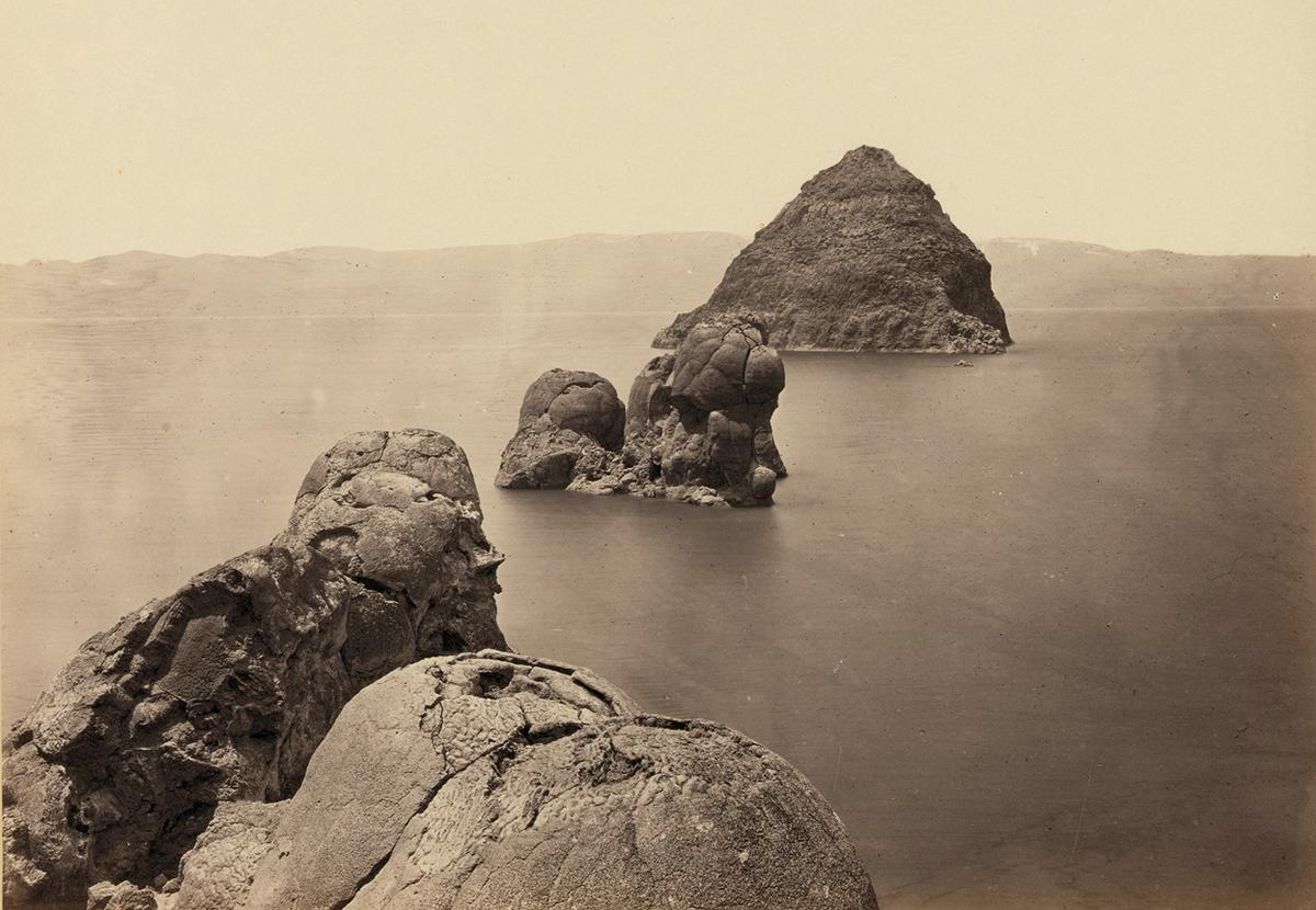
The Pyramid and Domes, a line of dome-shaped tufa rocks in Pyramid Lake, Nevada, seen in 1867
Members of Clarence King’s Fortieth Parallel Survey team, near Oreana, Nevada, in 1867

Twin buttes stand near Green River City, Wyoming, photographed in 1872
Pah-Ute (Paiute) Indian group, near Cedar, Utah, in 1872
Browns Park, Colorado, 1872
Via: The Atlantic, Etherton Gallery
Would you like to support Flashbak?
Please consider making a donation to our site. We don't want to rely on ads to bring you the best of visual culture. You can also support us by signing up to our Mailing List. And you can also follow us on Facebook, Instagram and Twitter. For great art and culture delivered to your door, visit our shop.