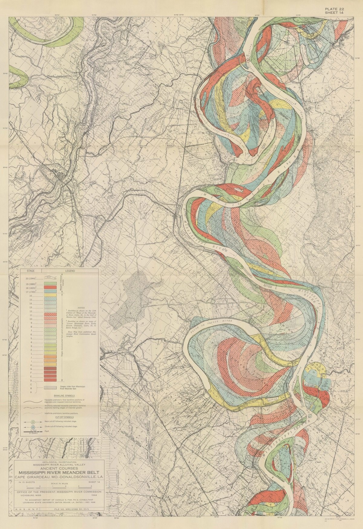
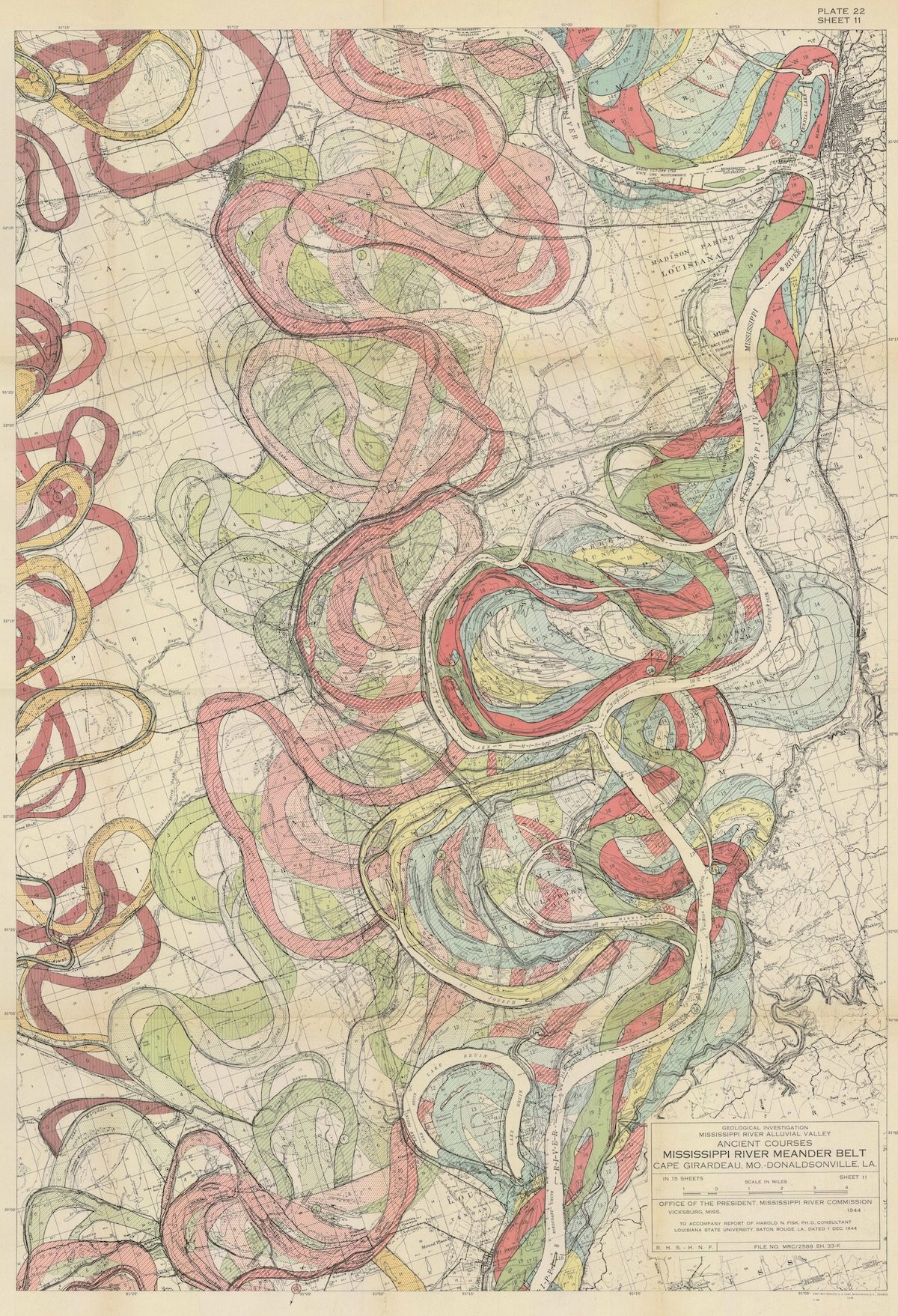
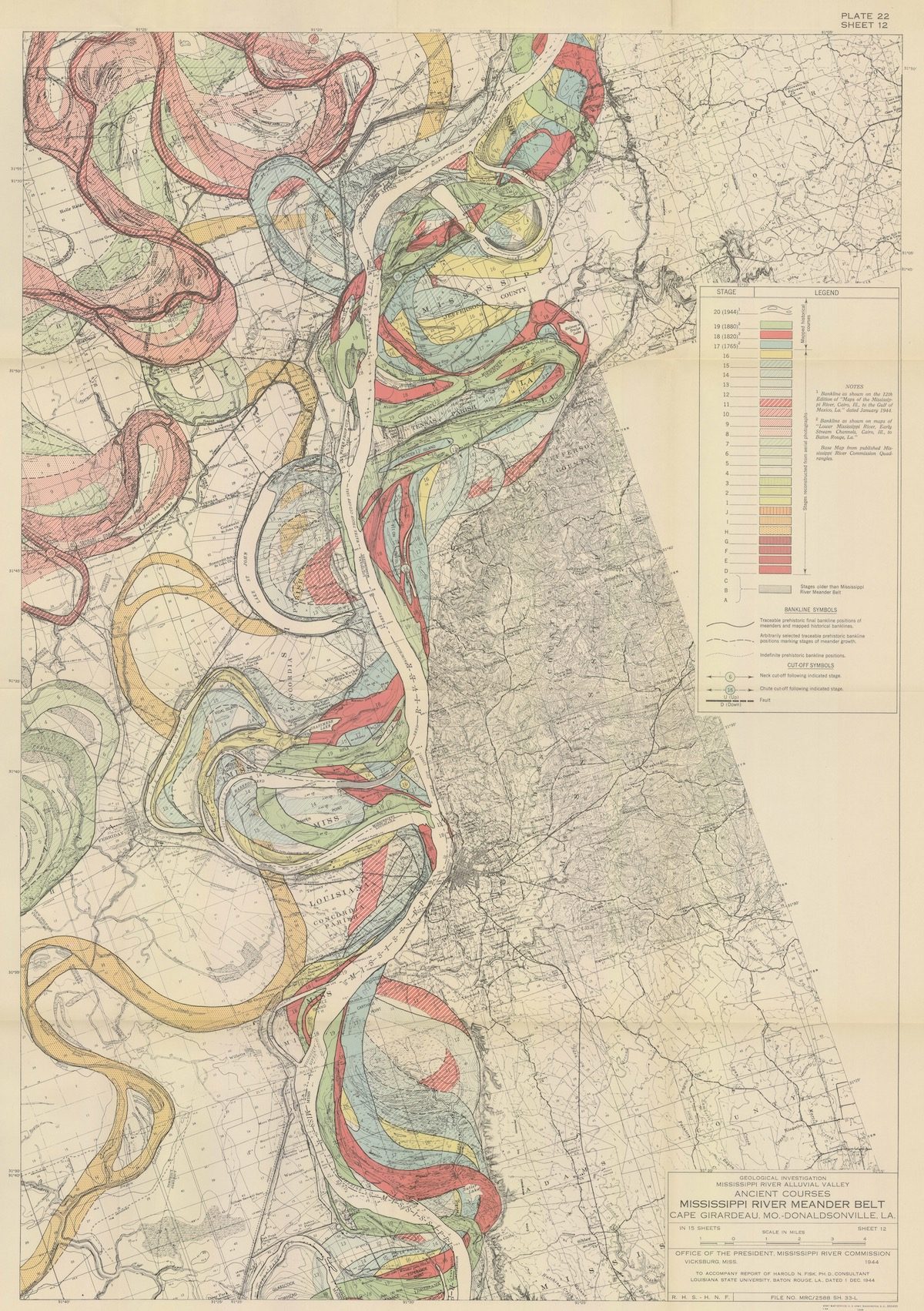
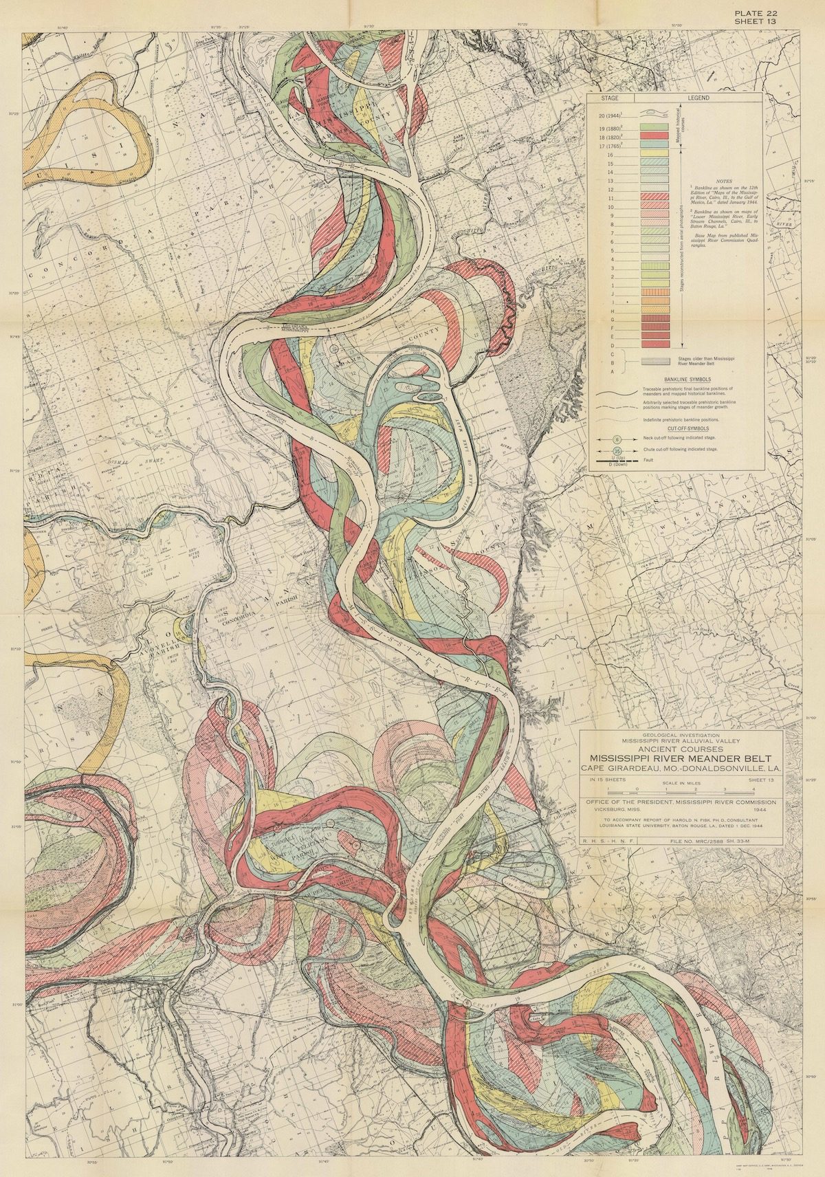
These fabulous maps were created by Dr Harold Norman Fisk for the 1944 study Geological investigation of the alluvial valley of the lower Mississippi River: U.S. Department of the Army, Mississippi River Commission. Fisk’s maps are data visualisation as art. His audience get to the know and understand the place with his use of colour, image, text and shape. All things combine to illustrate the dynamic history of the Mississippi River. The most striking are these, the 15 sheets that make up Plate 22, the meander maps of the Mississippi from Cape Girardeau to Donaldsonville.
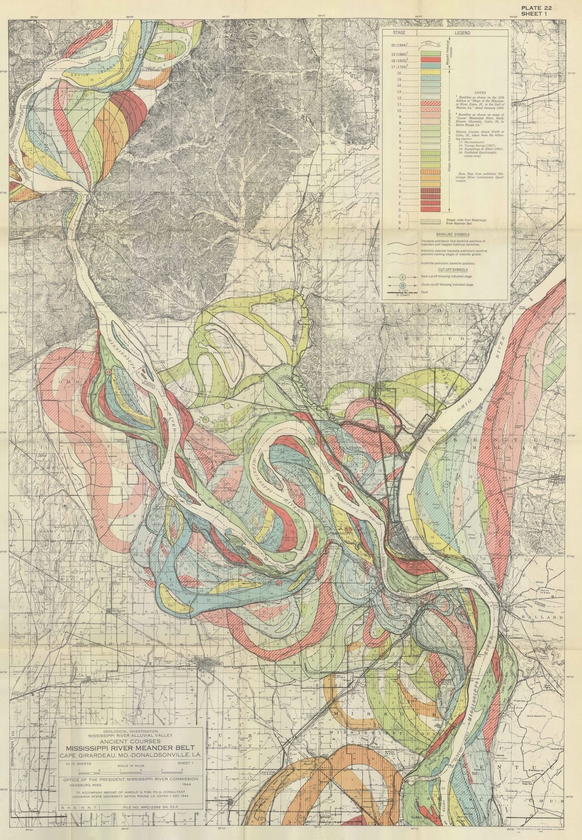
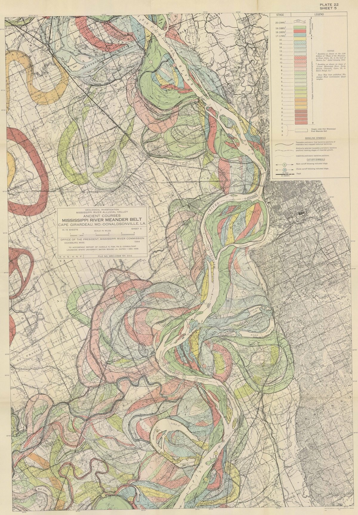
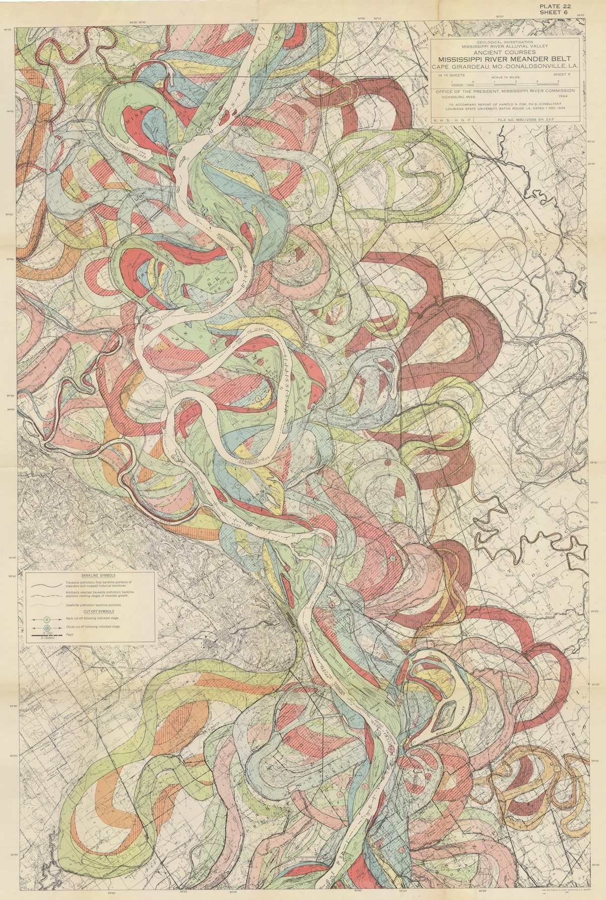
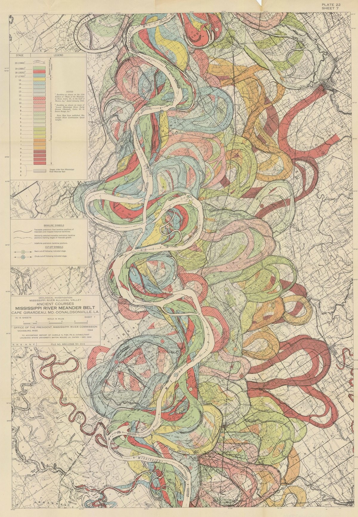
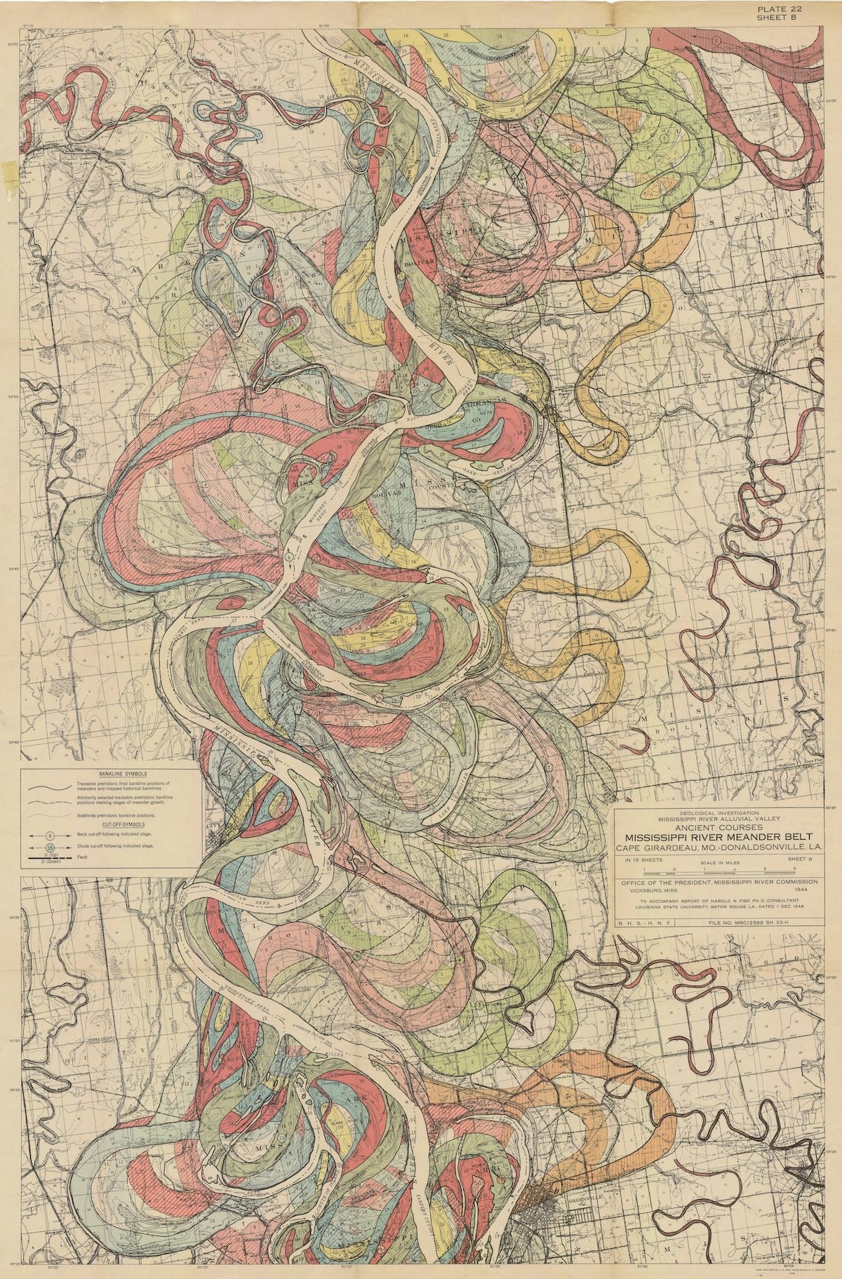
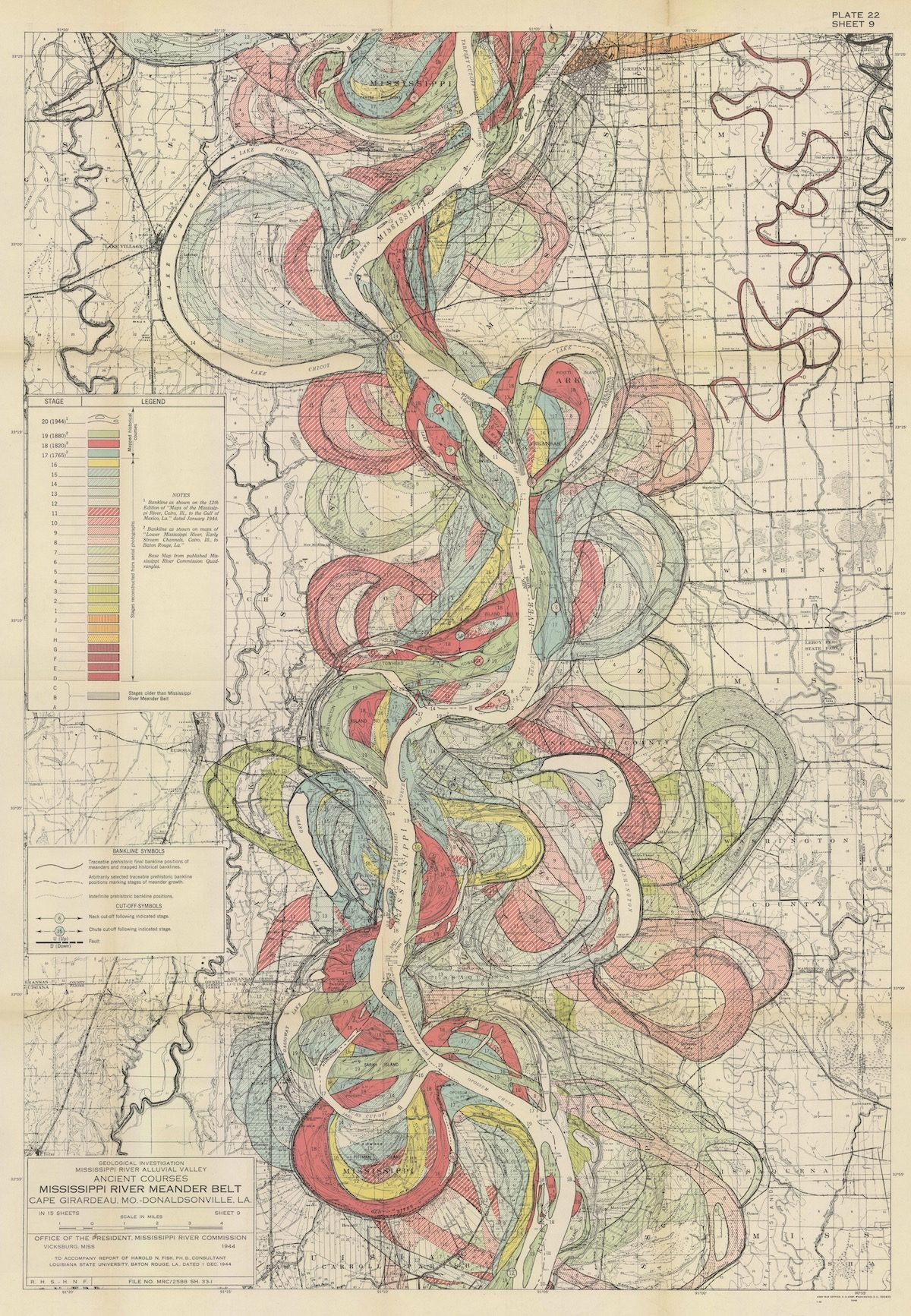
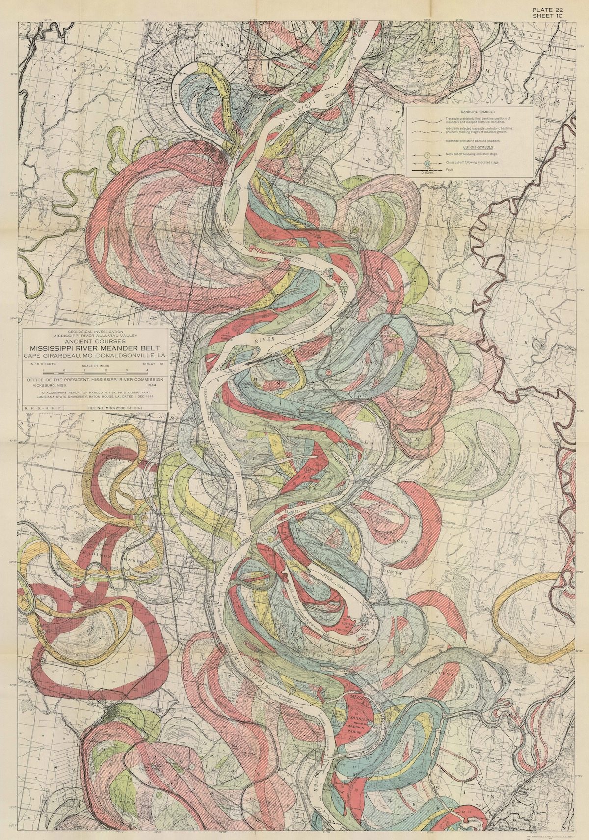
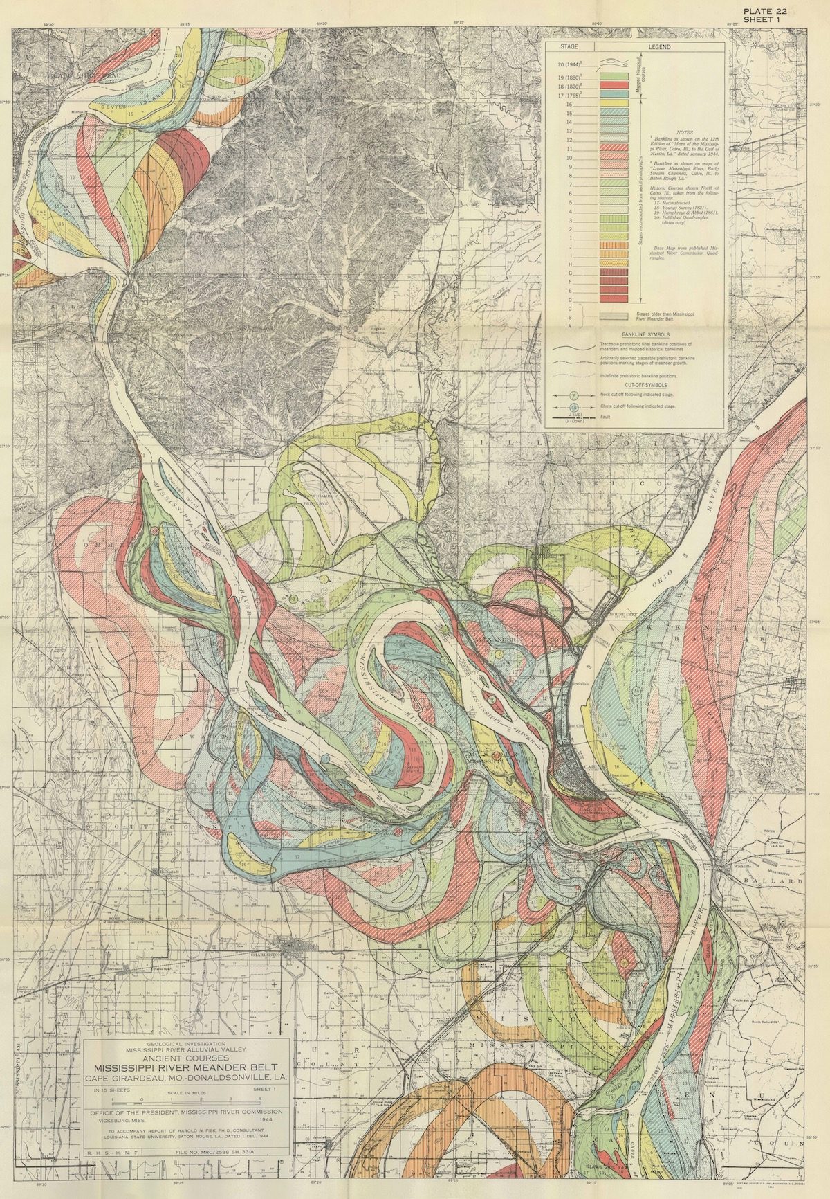
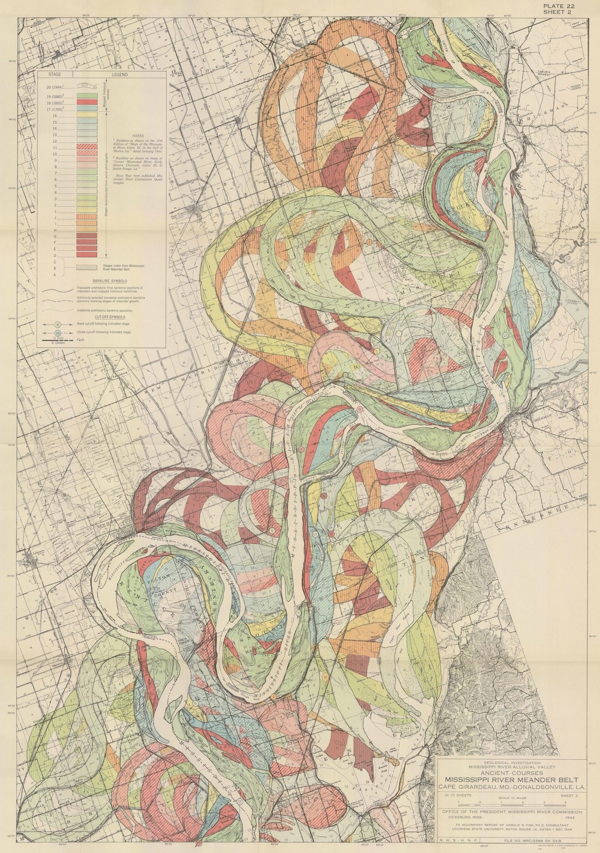
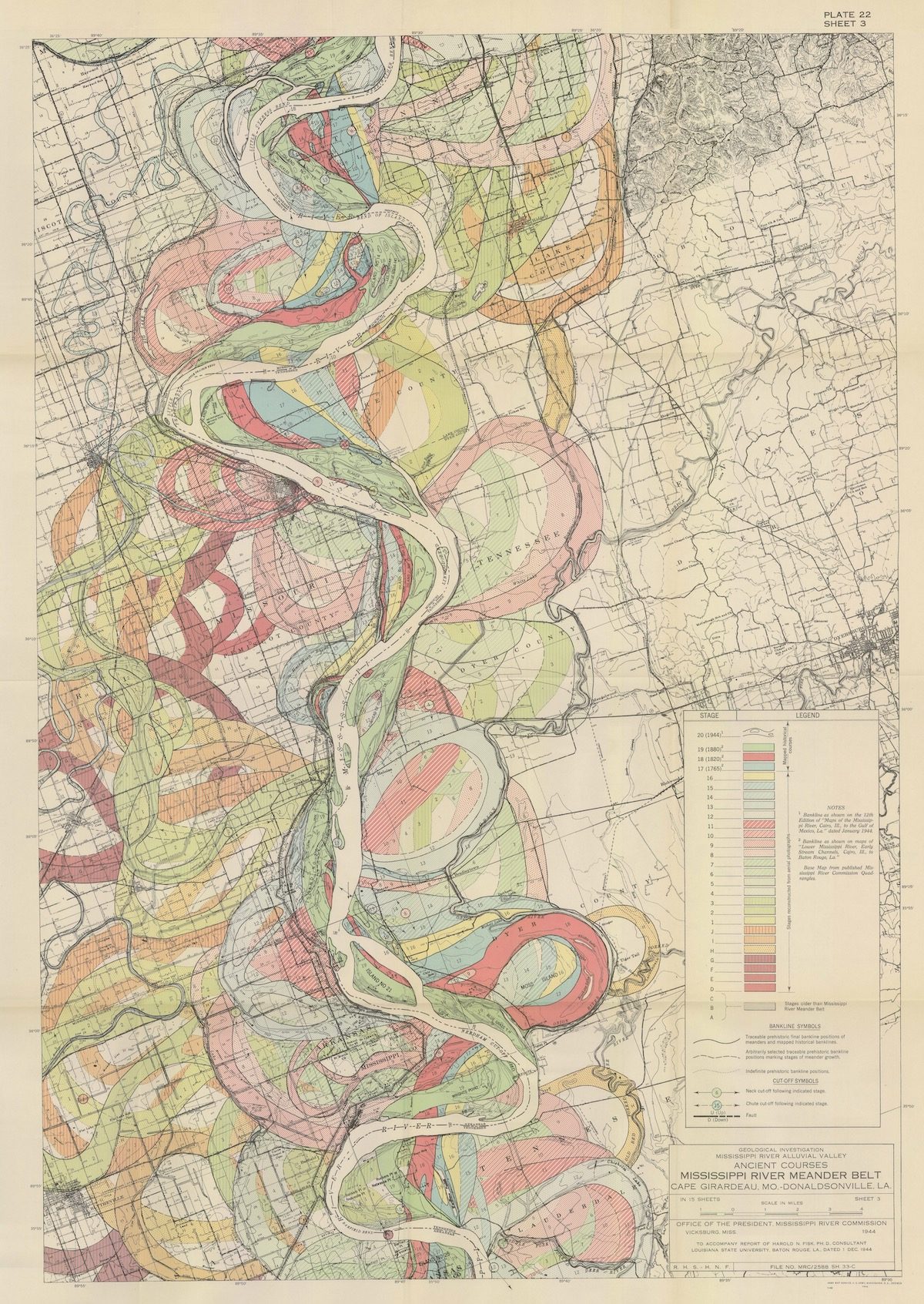
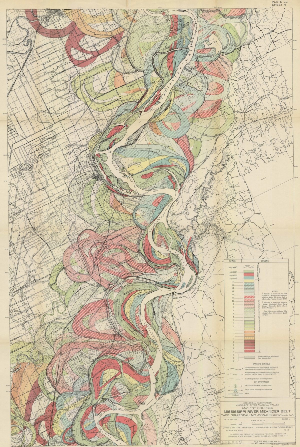
Radical Cartography has placed all 25 of Fisk’s maps in progression:
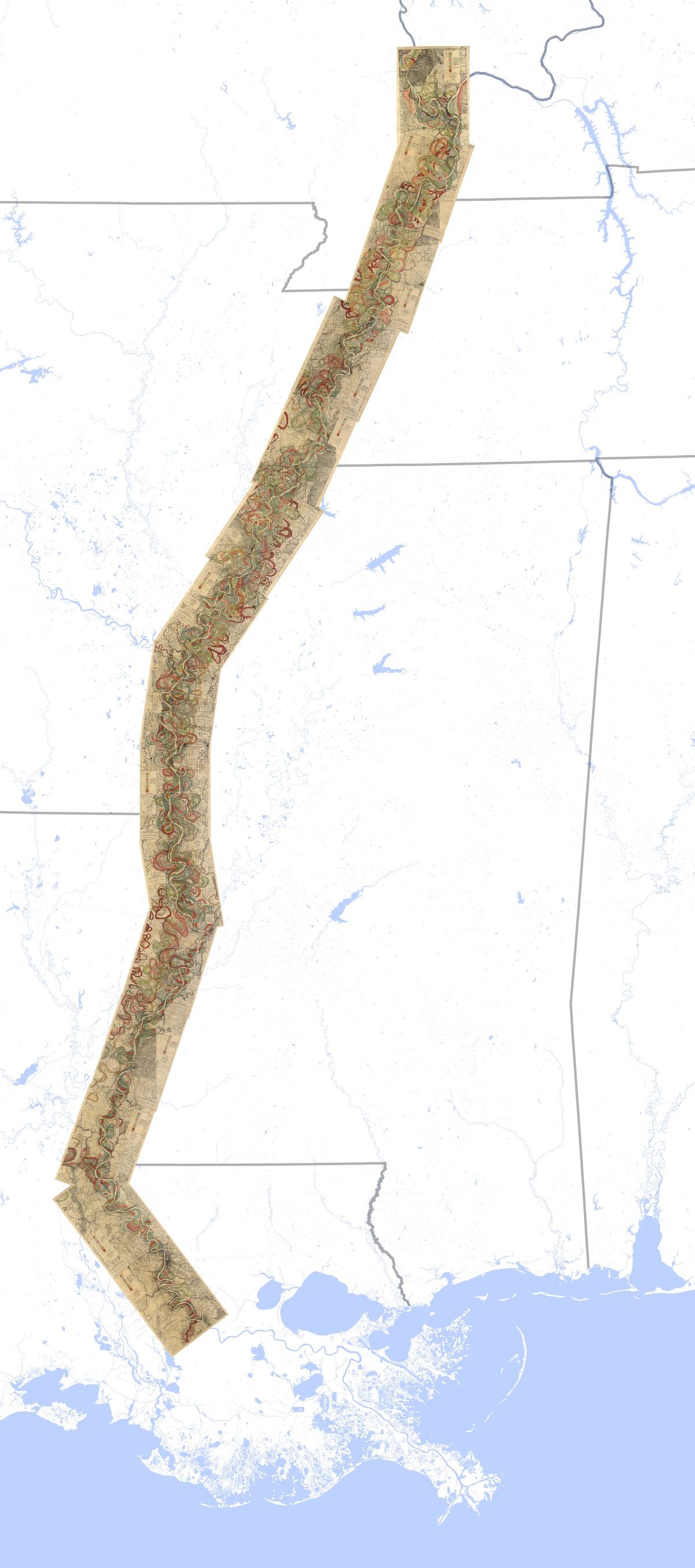
Via: Louisiana State University
Would you like to support Flashbak?
Please consider making a donation to our site. We don't want to rely on ads to bring you the best of visual culture. You can also support us by signing up to our Mailing List. And you can also follow us on Facebook, Instagram and Twitter. For great art and culture delivered to your door, visit our shop.


