SUSAN Schulton’s Mapping The Nation is a wonderful book showcasing “the complex and beautiful maps that spread through nineteenth-century America”.
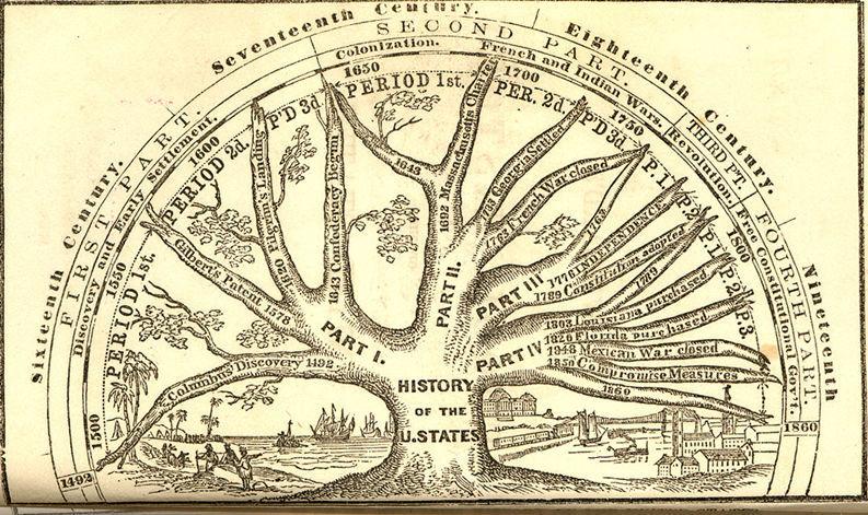
Willard used a tree to depict American history as a unified whole even as the nation was descending into Civil War. Though designated a history of the “U. States,” it begins with Columbus.
(1864) | Willard, Emma, 1787-1870
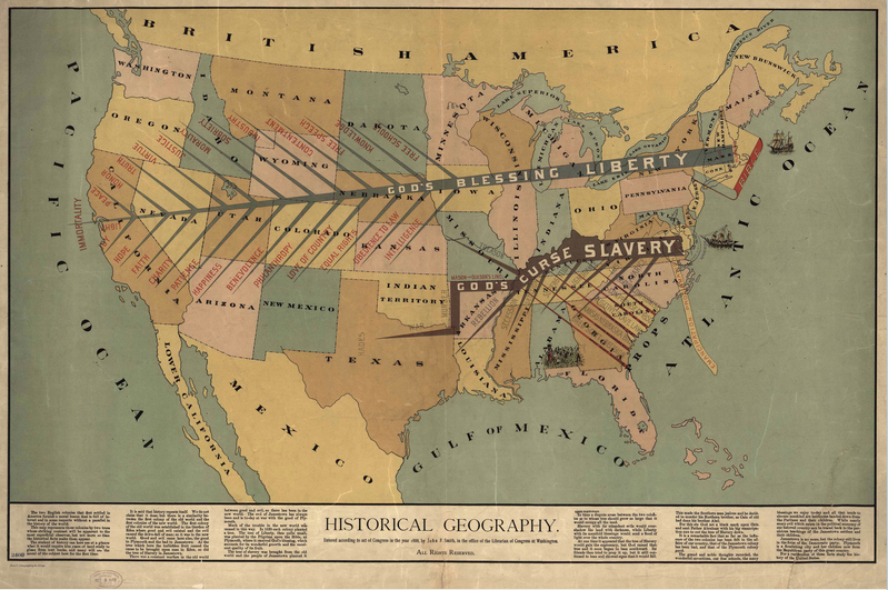
Notice the zealously sectional interpretation of history in this map, especially the identification of northern liberty as emanating from Christianity, in contrast to southern slavery.
(1888) | Smith, John F.
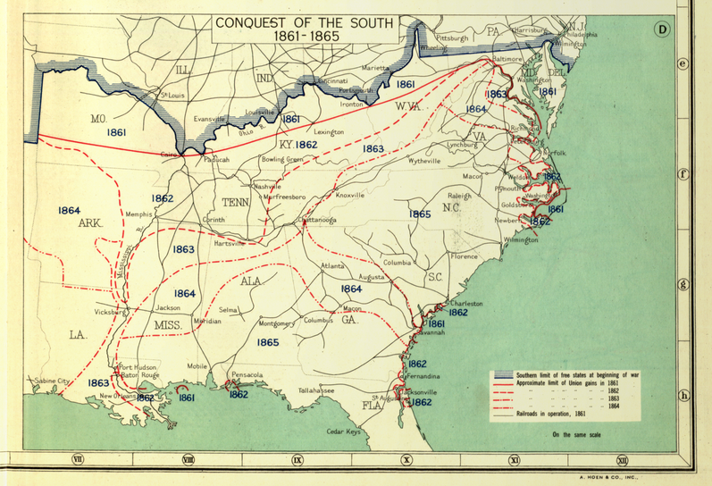
Conquest of the South, 1861-1865
Here the Civil War is represented in stages, as popularized by Henry Lindenkohl and the U.S. Coast Survey in the “Sketches of the Rebellion,” included above.
(1932) | Paullin, Charles Oscar, 1868 or 9-1944

Transportation and Rates of Travel
Here Charles Paullin represented advances in transportation technology in geographic terms in order to depict the qualitative changes over the course of American history.
(1932) | Paullin, Charles Oscar, 1868 or 9-1944
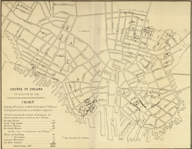
Course of Cholera in Boston in 1849
This is one of many examples of a map designed for etiological purposes, in this case to locate the source of the city’s 1849 cholera epidemic.
(1849) | Williams, Henry W. (Henry Willard), 1821-1895
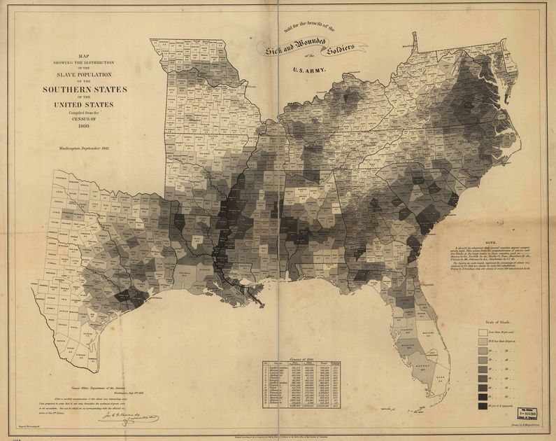
Map Showing the Distribution of the Slave Population of the Southern States
One of the first American attempts to translate the census into cartographic form, and a favorite of President Lincoln during the Civil War.
(1861) | Hergesheimer, E. (Edwin)
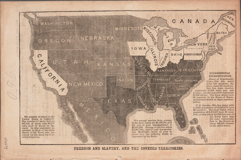
Freedom and Slavery, and the Coveted Territories
Anti-slavery activist John Jay used this map to alert northerners to the threat of slavery in the west, and to promote the cause of the newly-founded Republican Party in the 1856 presidential election.
(1856)
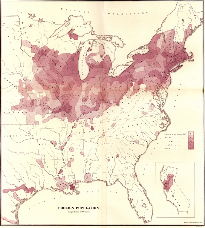
Map of the “Foreign Population” Compiled from the Ninth Census
This was one of Walker’s first attempts to map census data, and contemporaries noticed the stark comparison between it and the map of the “colored population” from the same report.
(1872) | Witzleben, Arthur de

Geological Map of the United States
This stunning map owed much to its antebellum maps of geology as well as the fine chromolithography of Julius Bien.
(1872) | Hitchcock, Charles H. (Charles Henry), 1836-1919
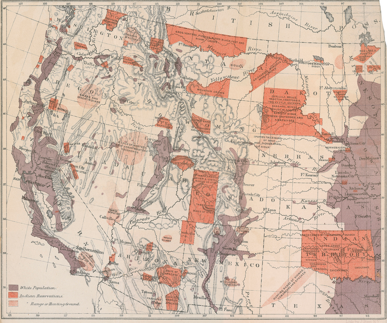
Map of Indian Population in the Western United States
Walker served as Commissioner of the Indian Bureau while also Superintendent of the Ninth Census in the 1870s, and in both capacities relied on maps.
(1874)
Spotter: Mapping The Nation
Would you like to support Flashbak?
Please consider making a donation to our site. We don't want to rely on ads to bring you the best of visual culture. You can also support us by signing up to our Mailing List. And you can also follow us on Facebook, Instagram and Twitter. For great art and culture delivered to your door, visit our shop.